
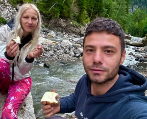
I know the Dolomites are famous for their via ferrata routes, but I wouldn't be able to tackle one, no matter how much I'd like to. Liga certainly wouldn't have any problems, but what can you do, she's more adventurous 😂.
So, I've chosen three easier trails (though they're not exactly a walk in the park), with three spectacular destinations: Lago di Sorapis, Tre Cime di Lavaredo, and Lago di Braies! Let's take them one by one.
Unforgettable trail to Lago di Sorapis
I don't even remember what I was looking for when I found the trail to Lago di Sorapis on the internet. What I do know is that I was completely enchanted by the color of the lake and decided that we absolutely had to go there! It is otherworldly, I've never seen anything like it. Absolutely fascinating!
Said and done! I thoroughly researched how we could get to the lake, as it is only accessible via the mountains. And I'm somewhat afraid to go on mountain trails, as I have a terrible fear of heights. So, even though the trail was categorized as easy-medium, I was interested in whether it was "with abysses" or not 😅.
After consulting many videos on YouTube and reading many articles, I finally understood that there are two trails to get to Lago di Sorapis, 215 and 216. Although it seems like handy information, not many people specify it. I thus found out that trail 215 is much easier and has only a few short, more dangerous sections, let's say, where metal cables are installed for you to hold on to. Trail 216, on the other hand, is much more demanding.
So, we decided to take trail 215 round trip to keep the adrenaline under control and to manage to see the fabulous lake! So, I'll tell you about this trail, how long it took, which parts were more difficult, and how spectacular it was!
Trail 215 to Lago di Sorapis
About the trail in brief:
Lago di Sorapis is a glacial lake at 1925 m altitude, with a splendid murky turquoise color. The colors intensify when the sun shines on the lake's surface.
Go here in the first part of the day when the sun is on the lake. After 1-2 PM, the sun goes behind the mountain. Trail 215 starts at Passo Tre Croci, precisely here, where you can leave your car in the parking lot or on the side of the road.
The trail is 5.3 km one way; we did it round trip and it took us about 2 hours to go and 1.5 hours to return. It's not very difficult but somewhat demanding in places.
It starts at 1805 m at Passo Tre Croci and ends at 1925 m at Lago di Sorapis, with some ups and downs. Non-slip shoes are recommended, preferably hiking boots.
We only had sneakers and managed without any problems. We don't have hiking boots; we considered buying them for this trail but ultimately didn't. We did it in sneakers and it was perfect; we didn't feel the need for anything more. Only that we got our sneakers quite dirty.
So if you have boots, preferably waterproof, as there are a few streams along the way, it's best to use them. If you don't have them or they don't fit in your luggage, you can also do the trail in sneakers.
The beginning of the trail
The first section is a leisurely walk through the forest, not demanding at all. It takes about an hour. At some point, the cliff starts to appear, but the path is very wide and there is no danger. And the scenery is breathtaking!
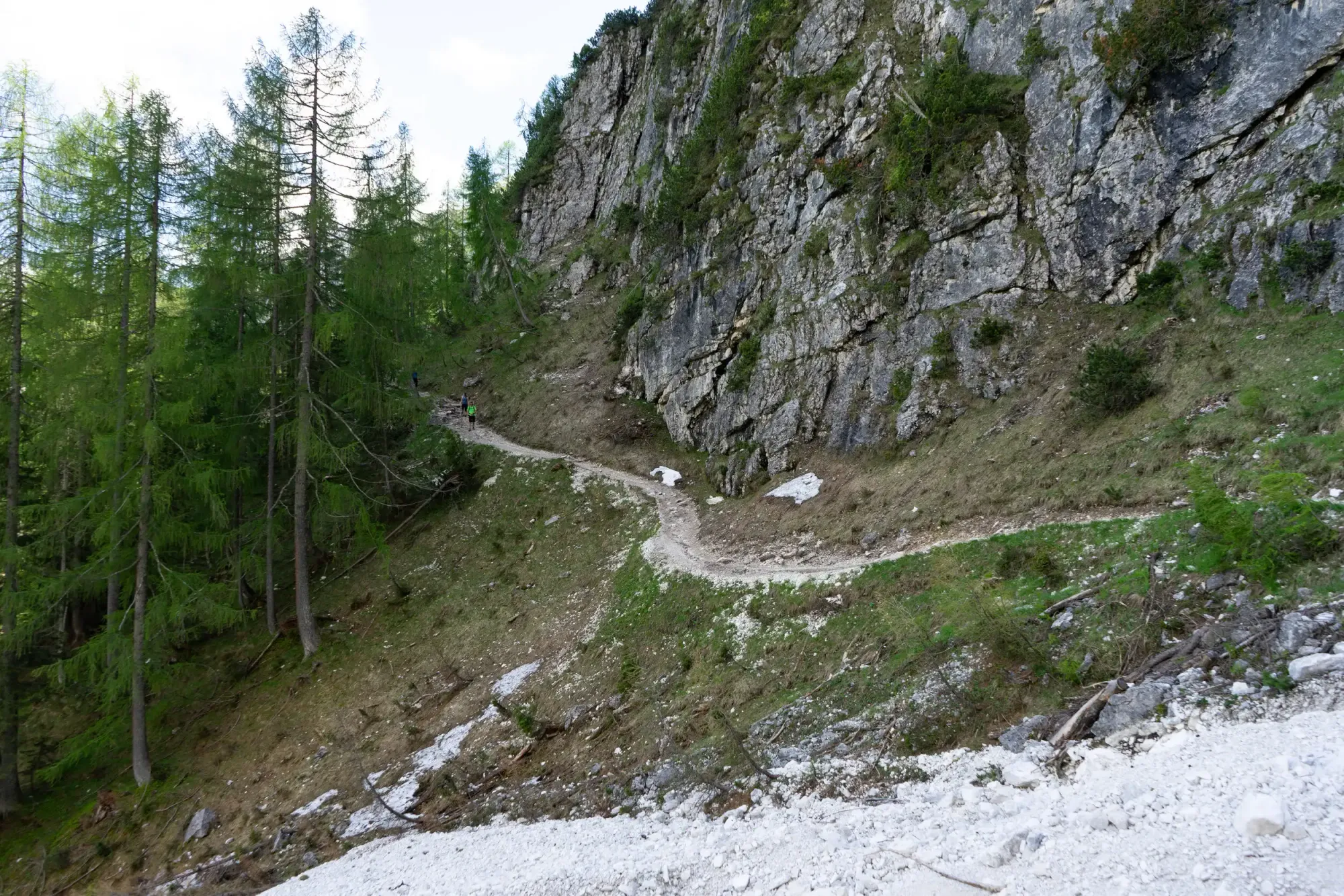
After about an hour and a quarter, we reached the section with metal stairs. They have a handrail, so you feel safe when climbing them. To get to the stairs, there's a section with a cable to hold onto if you need it.
About 5-10 minutes after the stairs, the sections with the metal cable fixed to the rock begin. There are about three sections, each about 10 meters long, and these are the only more "dangerous" parts of this trail. The rest is quite easy as you saw in the pictures, with a few more demanding ups and downs.
And this cable fixed to the rock is just for you to hold onto to avoid losing your balance; it's an additional safety measure, you don't need to clip onto it with carabiners.
Rifugio Vandelli – end of the trail
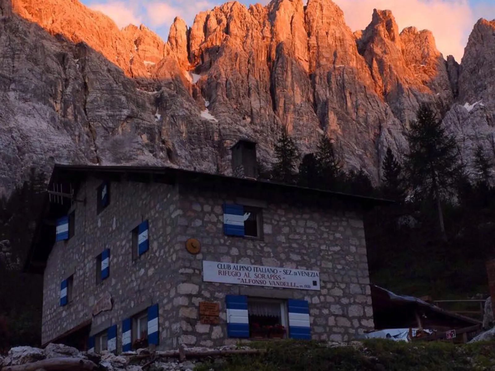
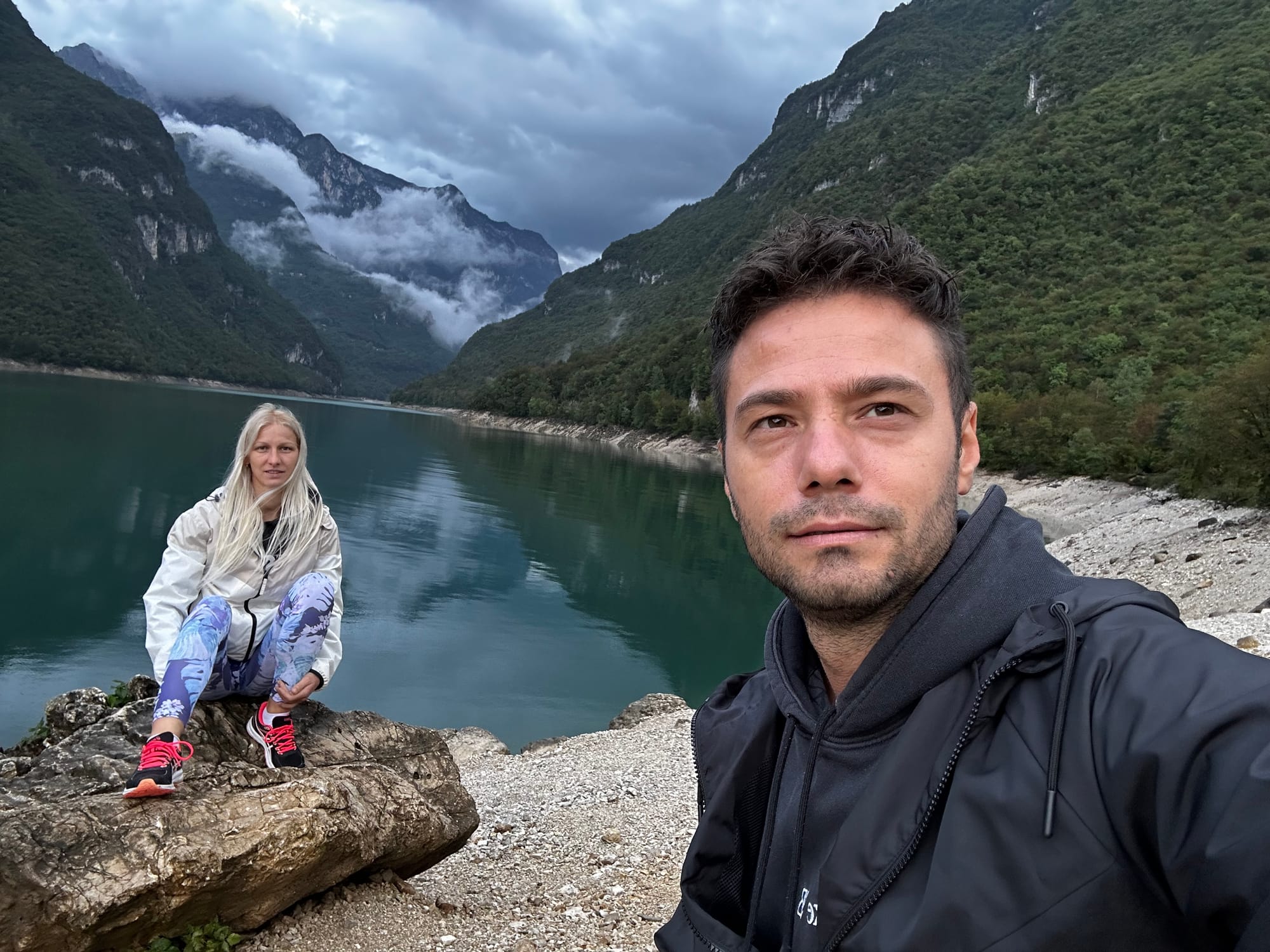
Next, we come across a crossroads and intersect with trail 216, which leads to Forcella Marcoira. We continue towards Rifugio Vandelli (rifugio means cabin). At one point, another crossroads appears; to the left is Rifugio Sorapis, and to the right is Lago di Sorapis. We rushed towards the lake, eager to see it! And... we arrive! Wow, what a color!!
It took us an hour and 55 minutes to get here. Lago di Sorapis, finally! We take a million photos and then relax and snack on what we brought with us. I read that you can walk around the lake, but at some point, there's a more dangerous section that is difficult to pass. So, we stay put, take our photos, and enjoyed the view.
As I mentioned, we returned via trail 215, and it took us an hour and a half on the way back.
Trail 216 is for the more advanced; it is much more exposed and steep. It starts with an ascent of about 200 meters and only then descends and intersects with trail 213, which takes you back to Passo Tre Croci. The more experienced hikers choose to take 215 on the way to the lake and 216 on the way back.
The trail to Lago di Sorapis – a must-see in the Dolomites!
I highly recommend this place; Lago di Sorapis is absolutely splendid, and the trail to get there is just as wonderful! The fact that you have to put in a bit of effort to reach it makes it even more special, appearing as a magical reward at the end of the journey. There are many beautiful places and trails in the Dolomites, but this one is not to be missed in my opinion; it is well worth it!
Spectacular Trail at Tre Cime di Lavaredo
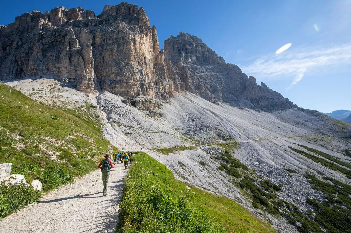
The Tre Cime di Lavaredo trail is a must-see in the Dolomites; the three peaks are superb and majestic! And you can only see them in all their splendor from the trail. In fact, there are multiple trails at Tre Cime, with varying levels of difficulty. We chose the easiest one, which is more of a walk at the beginning, with a healthy climb towards the end.
About the trail in brief:
- It’s a circular trail around Tre Cime (which means three peaks) of about 9 km
- It takes 3-4 hours to complete
- Elevation changes: 320m ascent, 310m descent
- It starts and ends at Rifugio Auronzo; you can reach this point by car or bus
- Sunsets at Tre Cime are splendid, but everywhere we found the recommendation to come here at 8 in the morning; otherwise, the trail and parking lot get extremely crowded in the afternoon, so we went in the morning
- You don't necessarily need hiking boots
- The trail in a few words:
- From Rifugio Auronzo, start on trail 101, keeping Tre Cime on your left
- Reach Rifugio Lavaredo and continue towards Forcella di Lavaredo
- Continue to Rifugio Locatelli
- Proceed on trail 105 towards Malga Langalm
- Continue back to Rifugio Auronzo
I would recommend doing the trail in this direction because towards the end there is a rather steep gravel slope that is not terribly difficult to ascend, but I imagine it would be much harder to descend.
How to get to Tre Cime di Lavaredo
You can drive to Rifugio Auronzo, where there is a large parking lot, but it costs €30 per car.
An alternative would be to leave your car down at Lago di Misurina and take bus 31 up to Rifugio Auronzo, which costs €8 per person round trip. However, the buses run quite infrequently, about once every half hour or hour. You can find the schedule here.
One bus 31 stop is here, and right next to it is a large parking lot, which costs €2 per hour or €14 for the whole day. It's quite expensive, so we saw many cars parked down the road near this hotel. We left our car up at Rifugio Auronzo to avoid wasting time with the bus.
The beginning of the trail: Rifugio Auronzo 2320 m – Rifugio Lavaredo 2344 m (trail 101)
The beginning of the trail at Tre Cime di Lavaredo is a smooth walk on a very wide path. We were there at 8 in the morning when the sun was just starting to rise from behind the mountains, and it was quite cold, about 9 degrees if I remember correctly (in mid-September).
Rifugio Lavaredo 2344 m – Forcella di Lavaredo 2454 m – Rifugio Locatelli (Drei Zinnen-Hutte) 2405 m (trail 101)
After Rifugio Lavaredo, there is a bit of climbing up to Forcella Lavaredo. In the picture below, the road goes a bit to the right, then climbs to the left up to the green crest seen on the left. The road is not very long. We were enveloped by clouds right at this spot, and when they spread apart, we could admire one of the Tre Cime, only for the clouds to come back again.
Further on, up to Rifugio Locatelli, it was an easy walk on a very wide gravel path (and very comfortable for me).
Rifugio Locatelli (Drei Zinnen-Hutte) 2405 m – Malga Langalm 2283 m (trail 105)
We didn't climb up to Rifugio Locatelli, as there are some stairs that lead there. Instead, we continued and at a crossroads saw a sign towards Langalm, and later Auronzo, on trail 105. The landscape is very beautiful, and the Tre Cime di Lavaredo stand proudly in front of us.
From here, a gentle descent begins into a valley, followed by a somewhat steeper descent on a series of switchbacks. I felt a bit nervous here because of the gravel underfoot, which makes it easy to slip. After this, there is a rather steep ascent up a slope. This climb was quite demanding, I believe not just for us who were not in great shape.
I would recommend doing the trail in the direction we did, so you don't have to descend here. I imagine the descent is very difficult because of the gravel, and you would need poles and possibly hiking boots. On the ascent, we had no technical problems, just that it left us breathless. After this valley, there are a few more ups and downs before reaching the Langalm hut, to the right of the Tre Cime.
Malga Langalm 2283 m – Rifugio Auronzo 2320 m (trail 105)
Towards the end, the trail is again quite smooth and the scenery is very beautiful, with Lago di Misurina visible in the distance below. We completed the entire trail in 4 hours, with only one stop of about 15 minutes at Langalm.
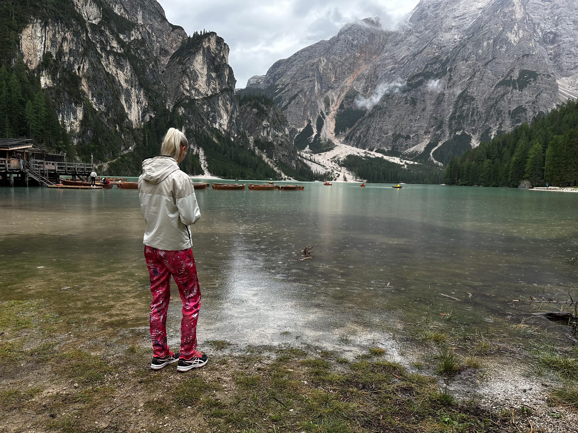
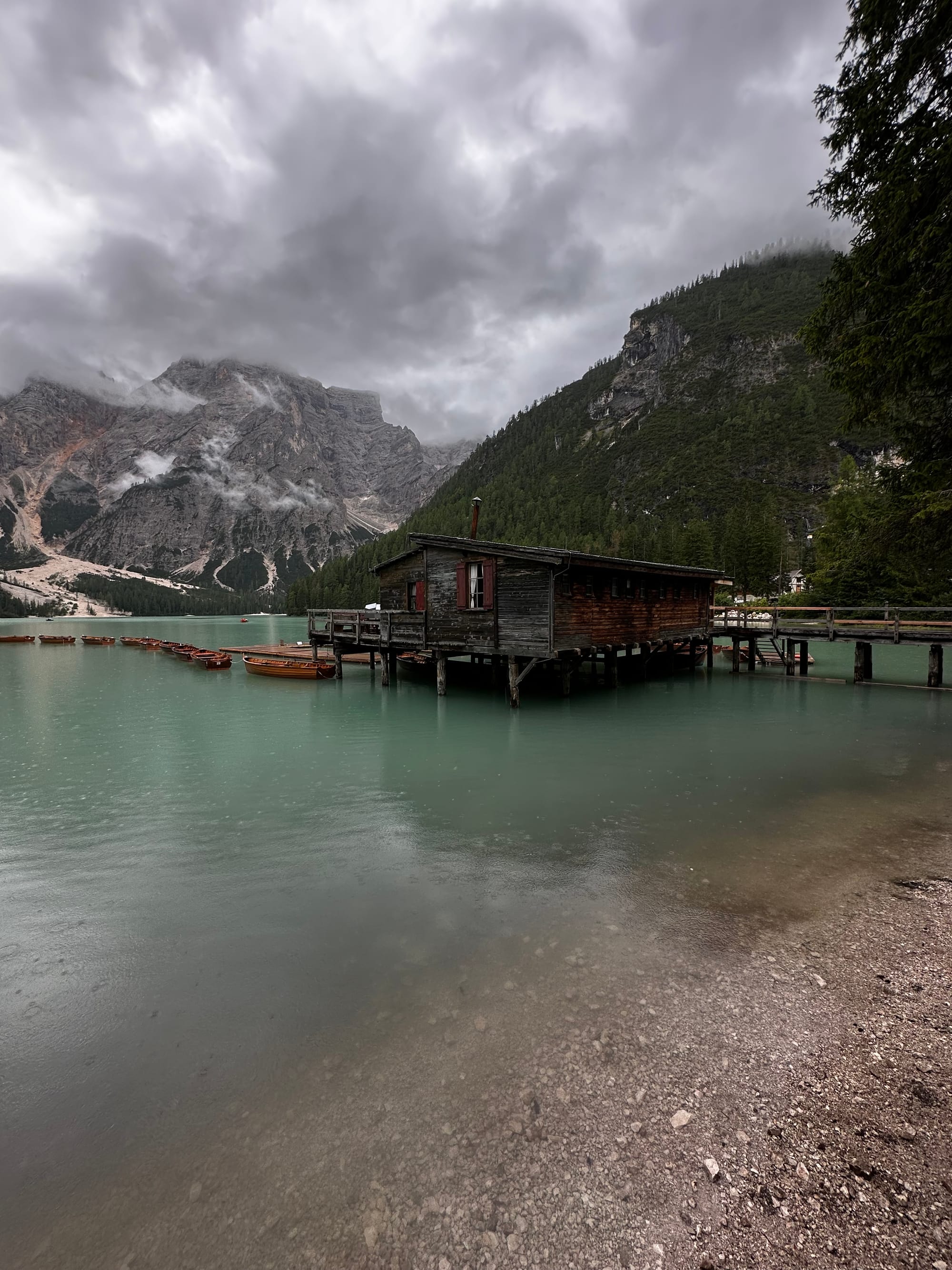
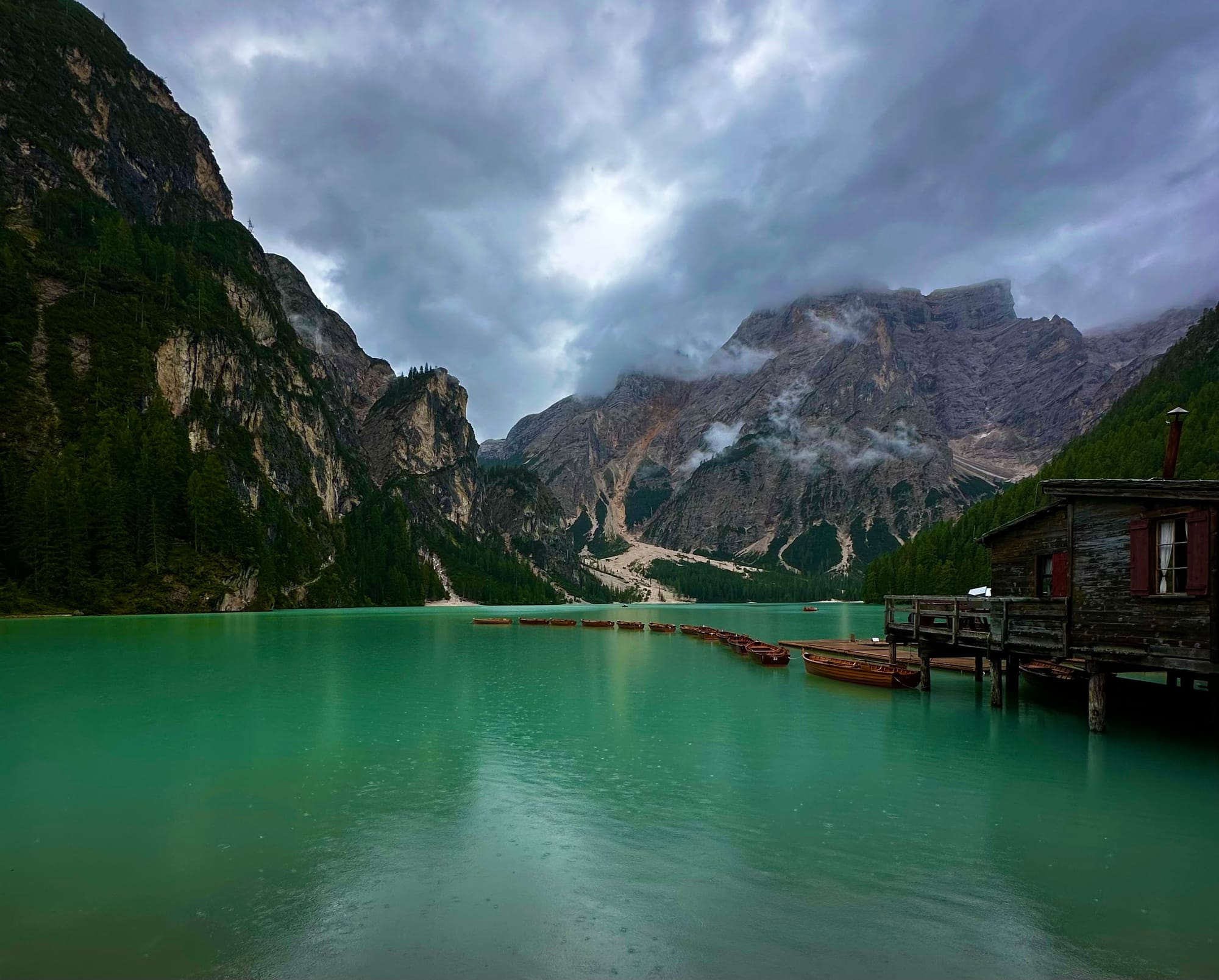
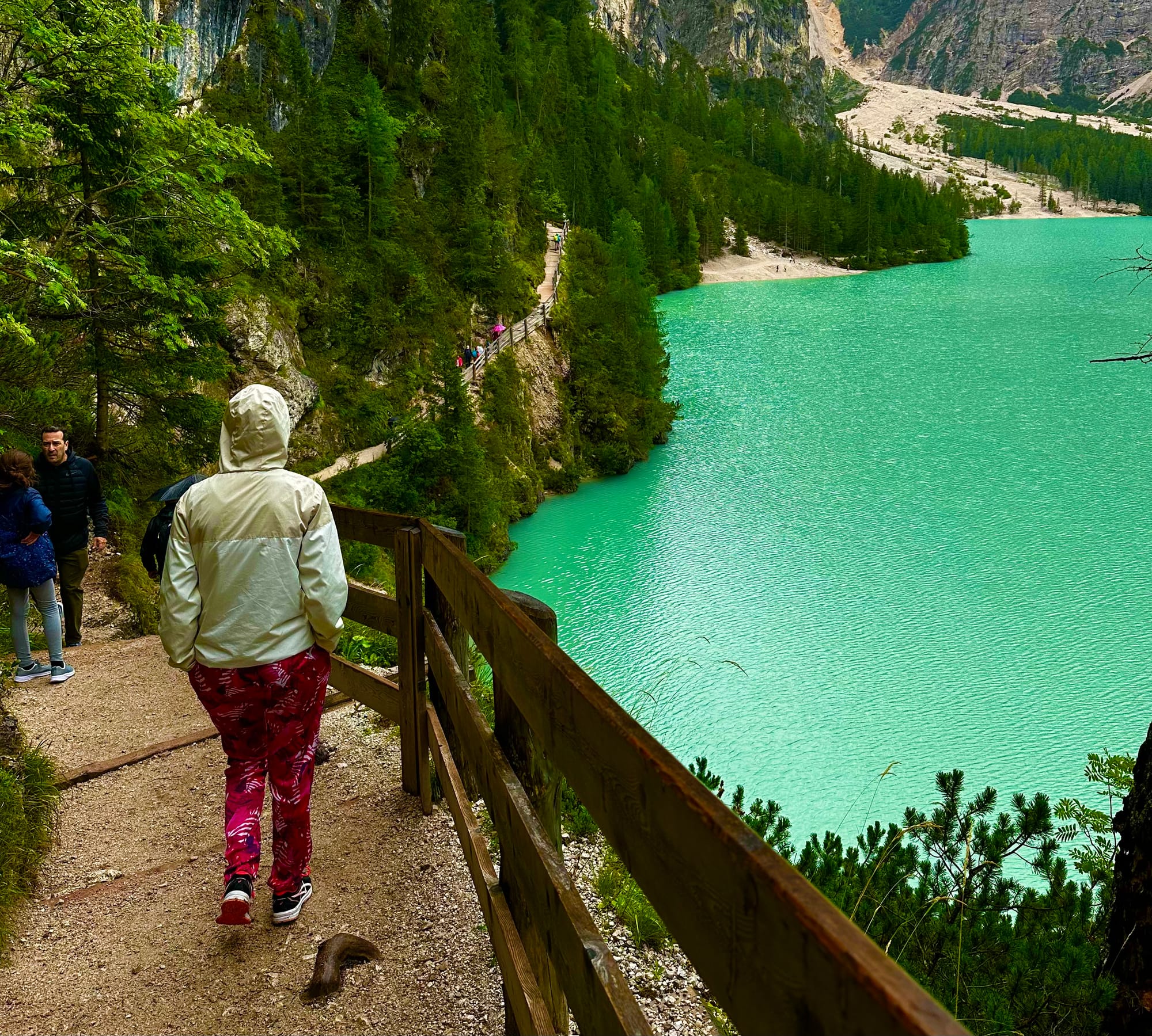
Colorful trail around Lago di Braies
I would have said that the trail around Lago di Braies (or Pragser Wildsee in German) is more of a walk, but I find it in the top 20 trails to do in the Dolomites, even rated as medium difficulty. Indeed, it has some ascents and descents, some through the forest, others on walkways and wooden steps. But all in all, it's not a difficult trail.
About the trail:
- It's a circular trail around Lago di Braies, 3.9 km
- It takes about an hour and a quarter to complete
- Elevation changes: 120m ascent, 120m descent
How to get to Lago di Braies
You have to come by car, and you will find a large parking lot right next to the lake, which I believe actually belongs to the hotel on the lake (Google Maps link here).
As you walk towards the lake, you will find a dock where you can rent a rowboat if you're feeling adventurous. The trail also starts from there; we went to the left and finished the trail at the same spot. There are wooden walkways on certain sections of the trail, and sometimes you climb to a height, which is great because it gives you the chance to see the lake in all its splendor!
Photos from the trail at Lago di Braies
Next, I'll leave you with some spectacular photos 😍! And perhaps a longing to travel and visit Italy? In any case, I must insist that what you see in the photos is real; the water of the lake is incredibly beautiful, and the mountainous landscape around it makes it truly unique!
These were the three easier trails we absolutely wanted to do in the Dolomites: Lago di Sorapis, the Tre Cime di Lavaredo tour, and the tour around Lago di Braies. They are not exactly very easy; the first two are somewhat demanding, but they cannot be compared to the via ferrata trails, for which you need a helmet, harness, and carabiners to clip onto the metal cable in the rock.
In addition, we found out about a few easy trails in the Dolomites that we didn't have time to try:
- Cinque Torri: Take the chairlift (seggiovia) from Baita Bai de Dones (Google Maps link here) to Rifugio Scoiattoli, and from there walk about 2 km to Rifugio Nuvolau. The altitude difference is 300 meters, the ascent takes about an hour, and the descent takes half an hour. You can also walk around Cinque Torri and visit the trenches from the First World War.
- Lagazuoi: From Passo Falzarego, you can either take the cable car or hike up Mount Lagazuoi. It's about a 2.5 km trail with a 600-meter elevation gain. I've read that the trail is not very difficult, but 600 meters is still not an easy climb. The lower cable car station is here, and you can start the trail from there. On Lagazuoi, there are also front lines from the First World War.
- Other easy trails: Here, here are trails for children in the Dolomites, here (search for the easy ones).
I hope I've inspired you to try at least one of these three trails when you go to the Dolomites. The reward is definitely worth it: views that will be hard to forget 😊!
