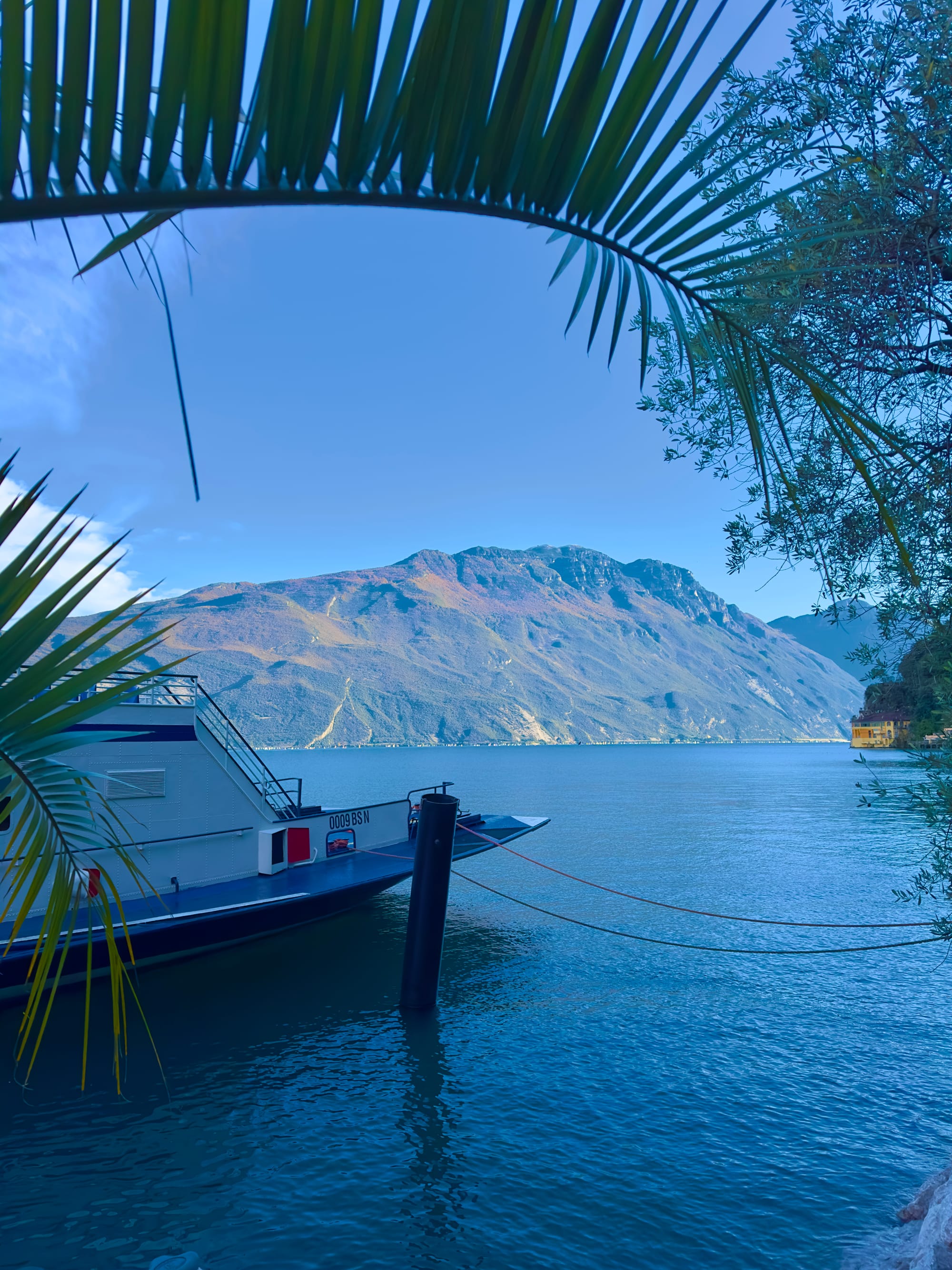
When it comes to exploring Lake Garda, I recommend circling it clockwise, starting from the south. I find this route to be more pleasant and it's easier to stop and not have to cross the road to access the closer lakeside viewpoints.
The road around Lake Garda is very narrow in places and can even be a bit dangerous. You may find yourself stopping at a small roadside stop to take a beautiful photo, but resuming your journey can be challenging due to the continuous stream of cars coming from a nearby bend. You might need someone else's help to get back on the road or make a sharp and risky maneuver to quickly merge into the traffic flow.
Sirmione
Coordinates: 45°29'13.2"N 10°36'34.9"E
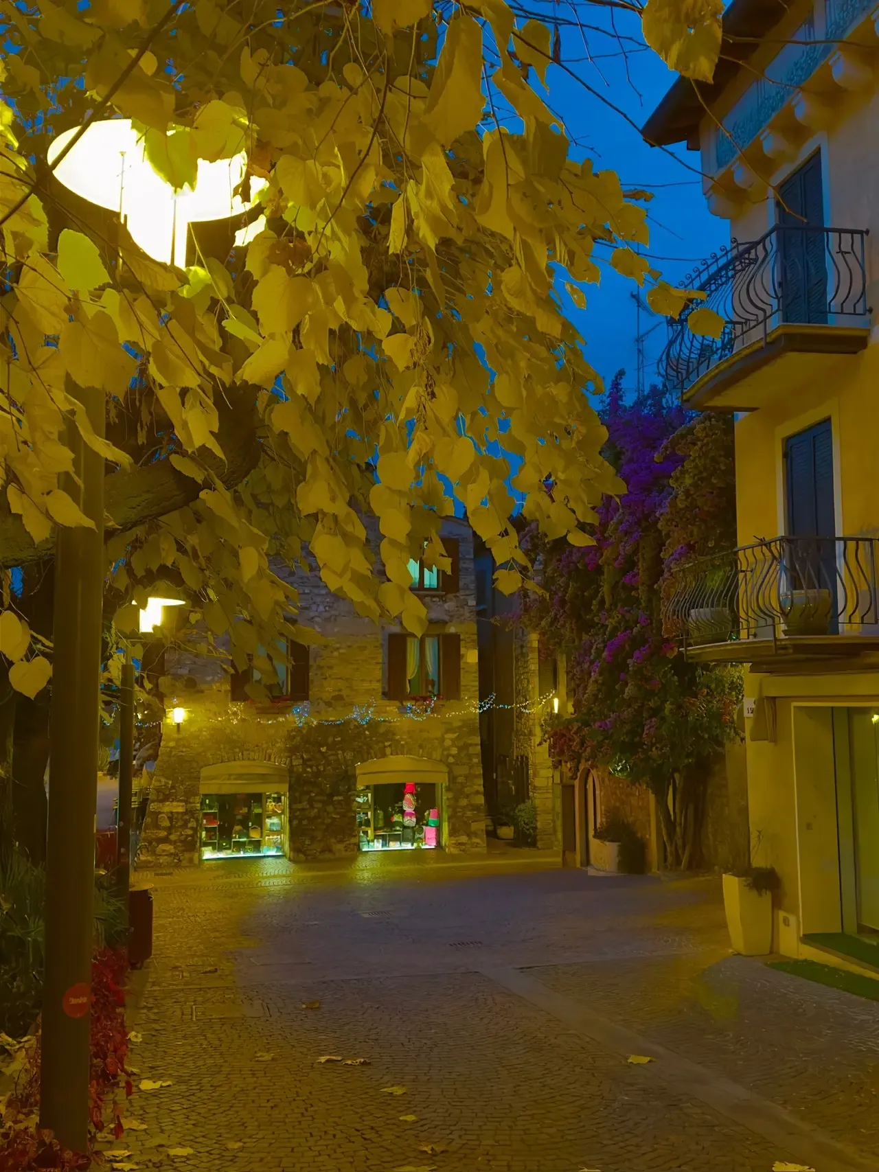
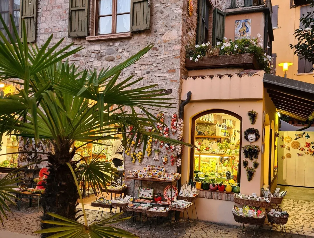
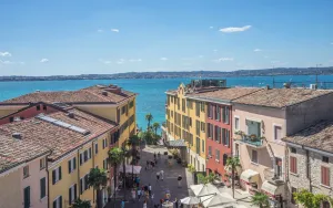
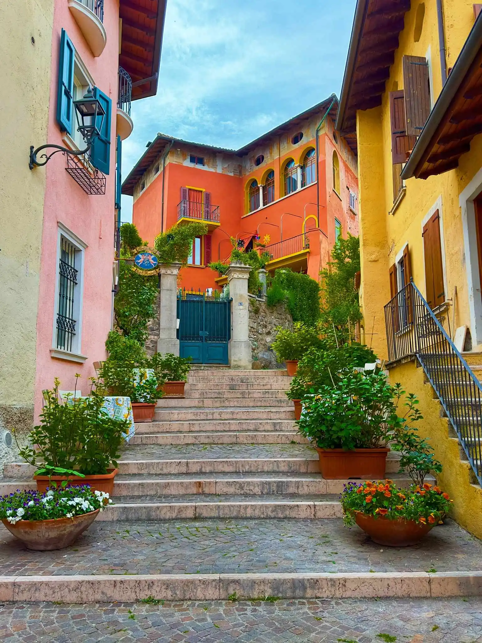
The medieval fortress town of Sirmione is located on a narrow, 5 km long peninsula in the south of Lake Garda. Cars are not allowed in the old town (this is a restricted traffic zone - ZTL!), so leave your car at Parcheggio Monte Baldo (or other parkplaces found nearby) for 3-4 hours and walk about a kilometer north along the souvenir and clothing market stalls to the Old Town.
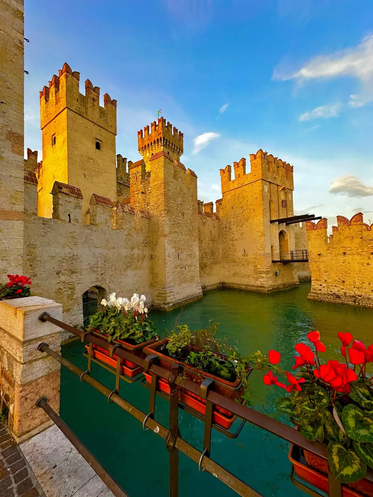
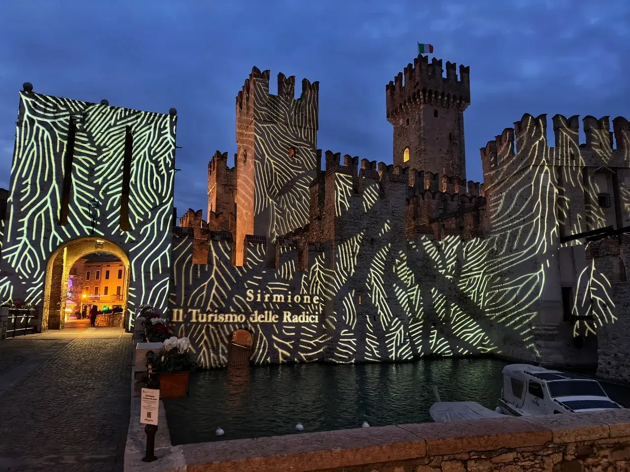
At the entrance to the Old Town is the well-preserved 13th-century castle, Castello di Sirmione, with an ancient drawbridge in its gates. The castle is surrounded by turquoise waters where you can observe huge fish.
Definitely walk through the Old Town with quaint, flower-covered houses and reach the end of the peninsula, where there's a beach called Jamaica Beach. It's interesting because it's not a standard beach. If you're a history lover, you can visit the Archaeological site of Grotte di Catullo, also located at the end of the peninsula.
On the way back, if you don't want to take the same road, you can turn left at the first opportunity (a path) and walk back along the lakeside.
And, if you're interested, you can enjoy the natural thermal waters at Aquaria Thermal SPA.
Rocca di Manerba
Coordinates: 45°33'23"N 10°34'08"E
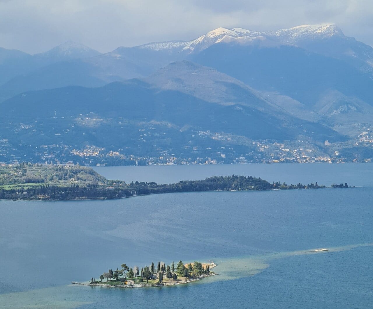
At Rocca di Manerba, you can see the remains of an ancient fortress, from which a wide view of Lake Garda is available. From the paid parking lot, climb about 400 meters up the hill, where you can spend a long time watching the Alps across the lake.
Further, when you reach the cross, a 500-meter path leads down to Punta Sasso - a steep cliff by the lake, where you can further explore the area. If you want to visit both, plan 3 hours for this stop. The castle hill visit is free.
If you're a history enthusiast, the next place is Vittoriale degli Italiani.
Il Vittoriale degli Italiani Park
Coordinates: 45°37'24"N 10°33'57"E
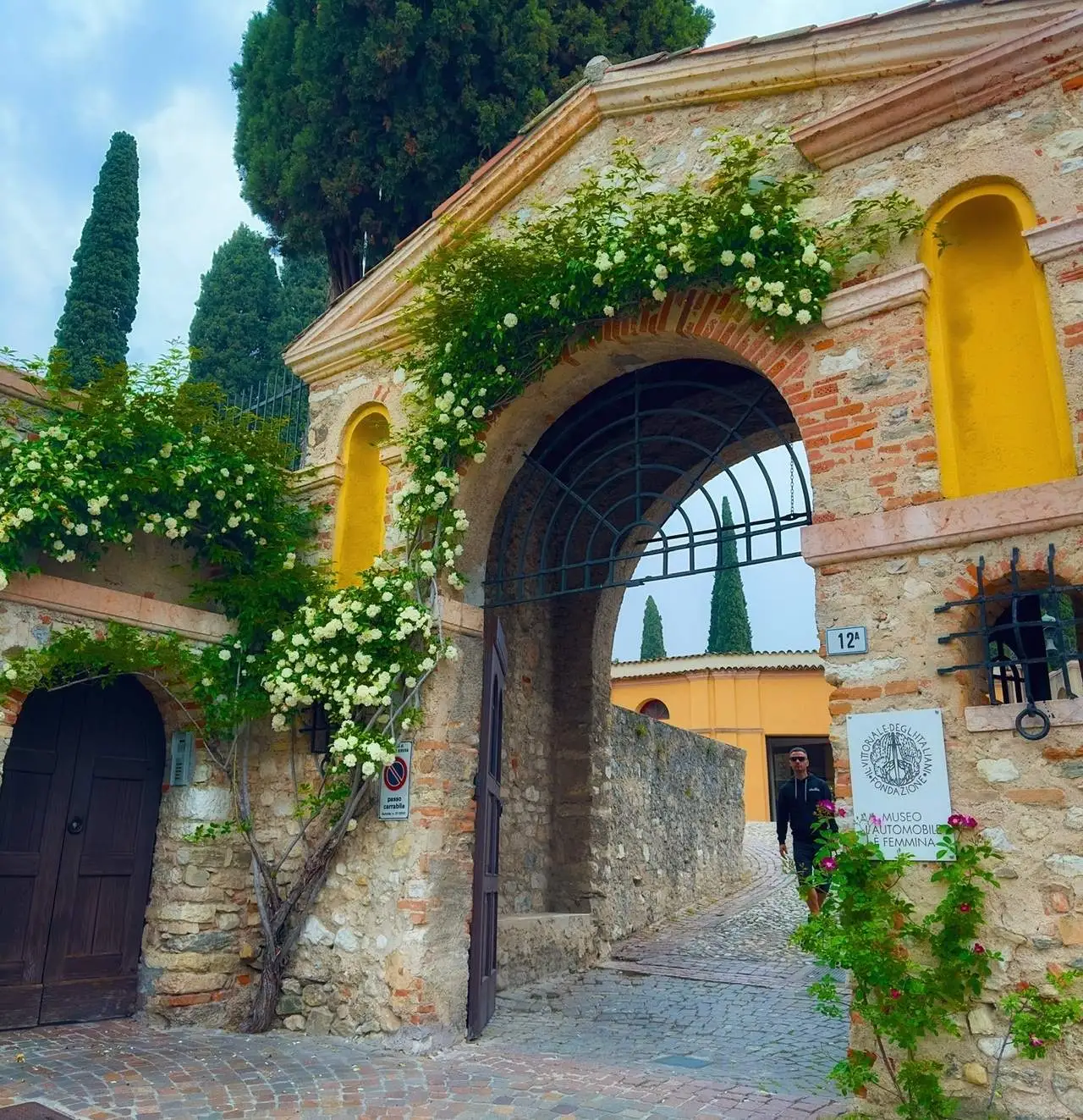
Continuing along the lake to the north, in Gardone Riviera, is the remarkable Il Vittoriale degli Italiani park. From the parking lot, turn right onto the road, and the entrance will be on the right.
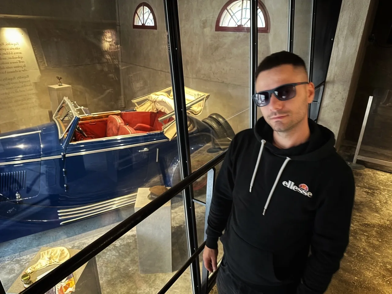
This complex of buildings, squares, gardens, and parks was built from 1921 to 1938 by Gabriele d'Annunzio, with the park designed by architect Giancarlo Maroni, depicting the poet-soldier's "unforgettable life" and Italian heroism during World War I.
The park features an amphitheater by the lake, a warship, a mausoleum, a private car and plane collection, a waterfall, sculptures, and impressive buildings. It all once belonged to one man. The entrance fee is €16, and the visit can take around 3 hours.
Montecastello Monastery
Coordinates: 45°44'31"N 10°43'59"E
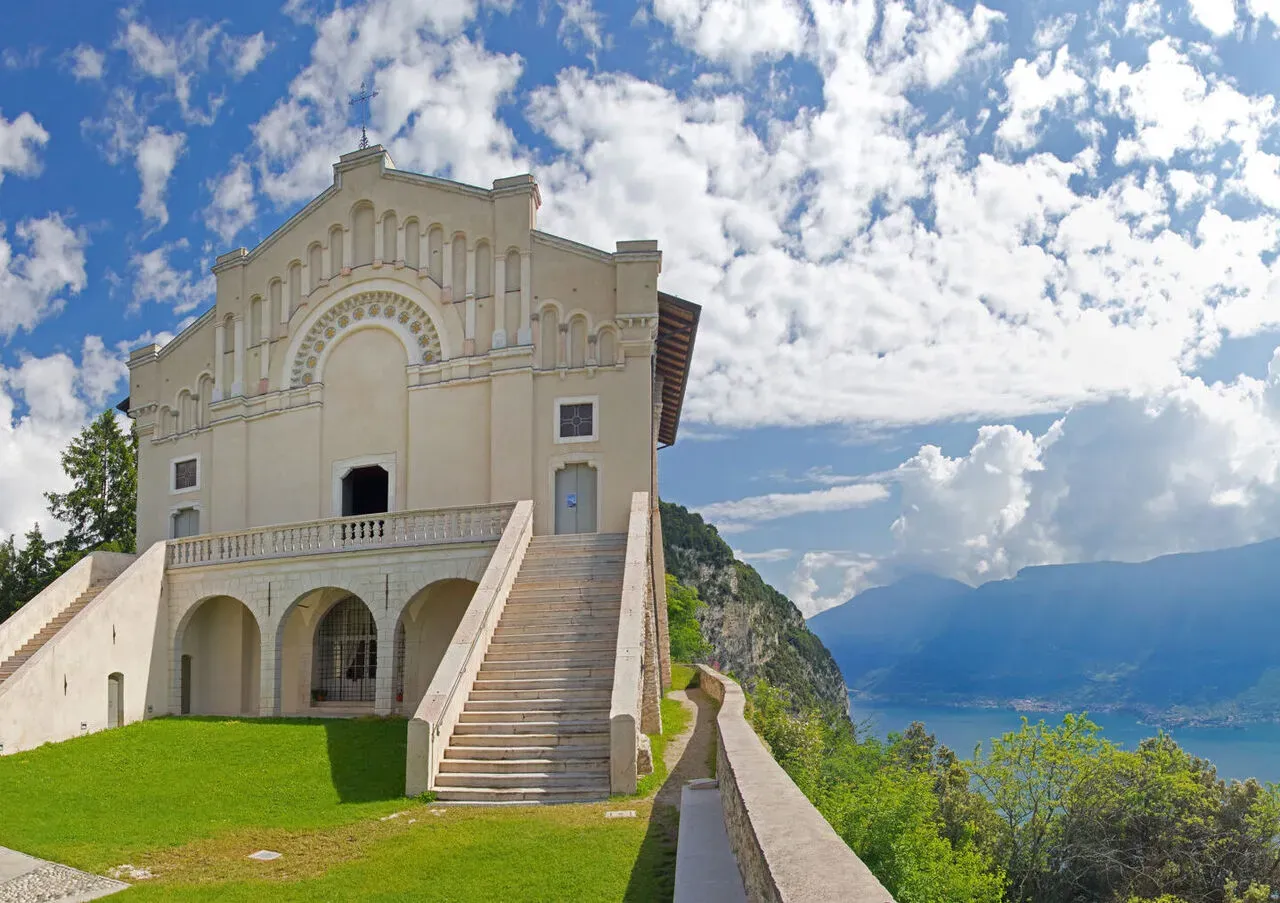
Moving on after about 25 km, stands the Montecastello Monastery on a steep hill by the lake. If you are driving there, do not be afraid of the last few hundred meters up a very steep hill – the road surface is specially ribbed for this purpose.
There is free parking right next to the sanctuary. Nearby, you will also find one of the many giant benches installed in Italy - La panchina gigante, offering beautiful panoramic views.
Strada della Forra and Tremosine (Pieve)
Coordinates: 45°46'36.2"N 10°45'37.4"E
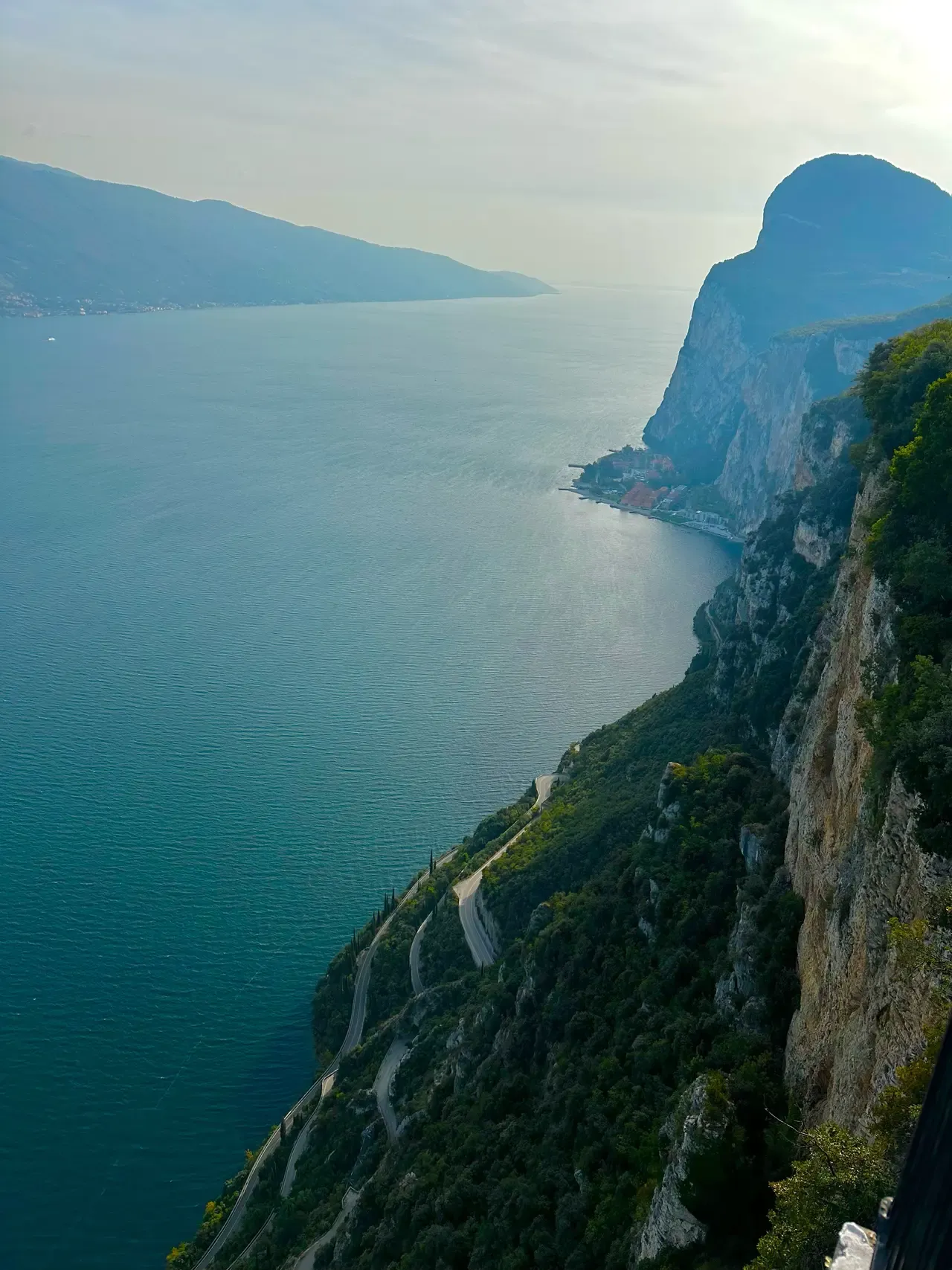
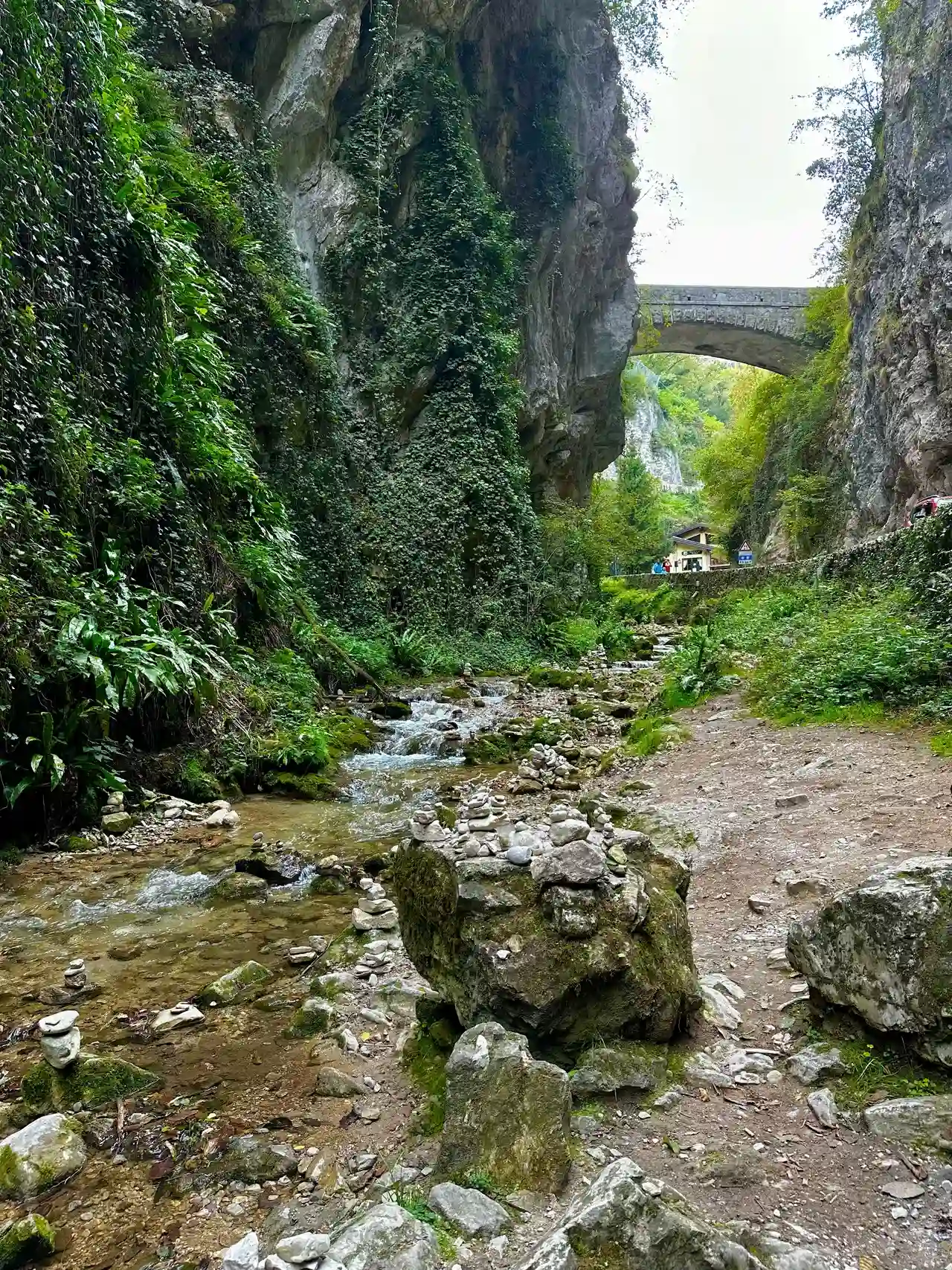
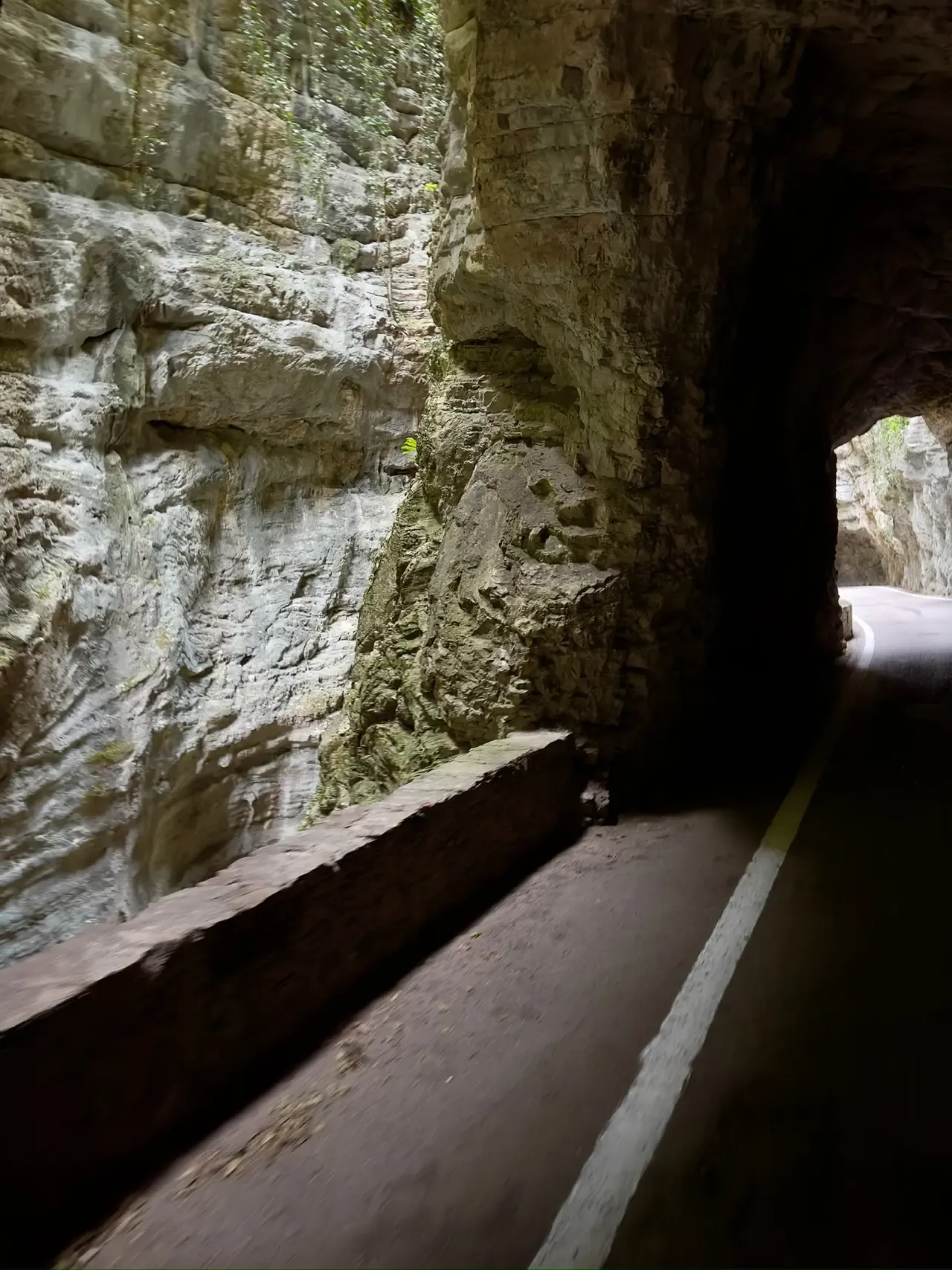
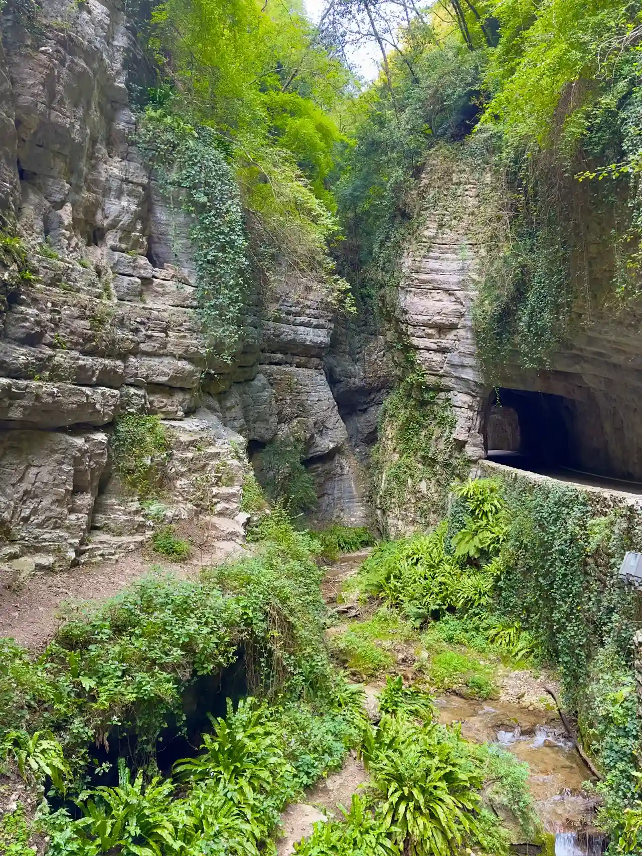
A beautiful road with impressive views, leading to the village of Pieve di Tremosine. The approximately 5 km winding road, built a century ago, leads through several tunnels, along steep cliffs, and sometimes even along the edge of the abyss. In places, the road is so narrow that traffic is regulated in one direction by a traffic light.
When the cliffs start to overhang, try to find a spot to stop and enjoy the views. Just past the restaurant, there's a path leading to a kind of gorge. You can't go deep, but it's beautiful.
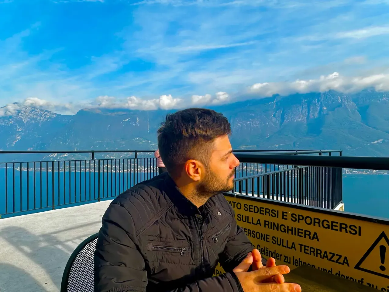
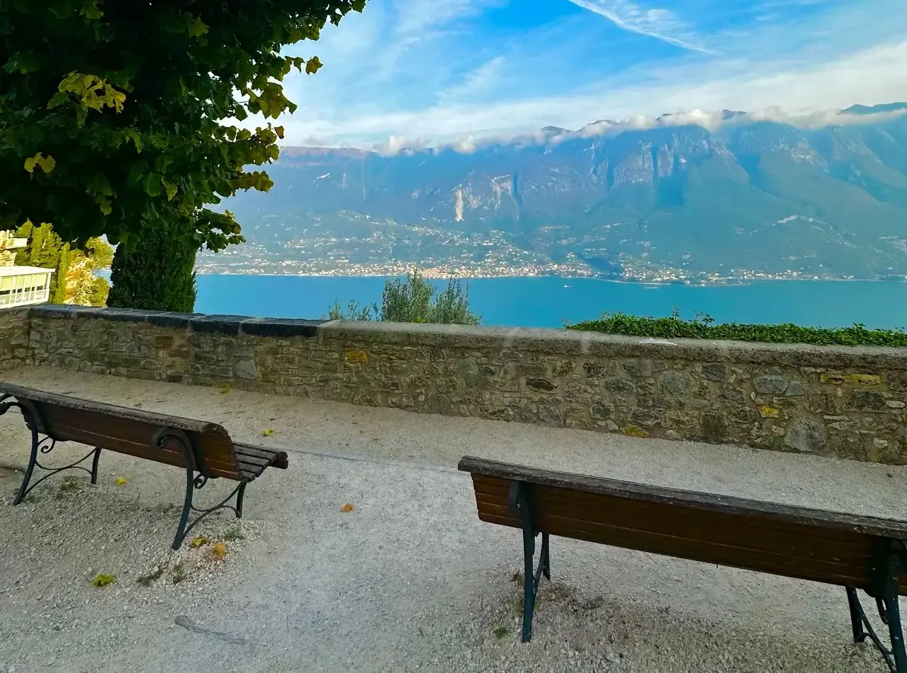
When your tour here is over, you can continue up to a village. Once at the top, you will reach the historic center of Pieve. A few steps from the parking lot (45°46'16"N 10°45'34"E) is the Church of St. John the Baptist, built in the late 16th century, with a square next to it offering breathtaking views over the lake and Monte Baldo.
To the left, you will see houses built on steep cliffs, including a hotel restaurant terrace carved into the rock, hanging over the abyss. It's truly a marvel how people aren't afraid to live on the edge of a cliff.
Walk through the village, and a few hundred meters south towards the mountain, you will see the Hotel Paradiso on the left side of the road. Walk past it towards the lake, and through the hotel lobby, you will reach the Terrazza del Brivido (“Thrill Terrace”), offering unforgettable feelings at over 300 meters high! However, if you are not a hotel guest, you will need to order at least a cocktail or a glass of wine to access the terrace.
Note that serious meals are not available during the day, usually only until around 1 PM and after 6 PM, and this can be the case in many remote places. But you can always enjoy an Aperitivo, served with some snacks.
Looking down from this terrace, there is nothing but the peaceful lake, the winding gorge road, and the dizziness-inducing view.
A tour of the Strada della Forra (Road of the Gorge) and the village will take 2-3 hours.
Traffic is only allowed uphill during the day. If you must drive down, look for a detour through the village of Vezio, which will take you right into the beautiful town of Limone Sul Garda.
Limone Sul Garda
Coordinates: 45°48'45.9"N 10°47'40.2"E
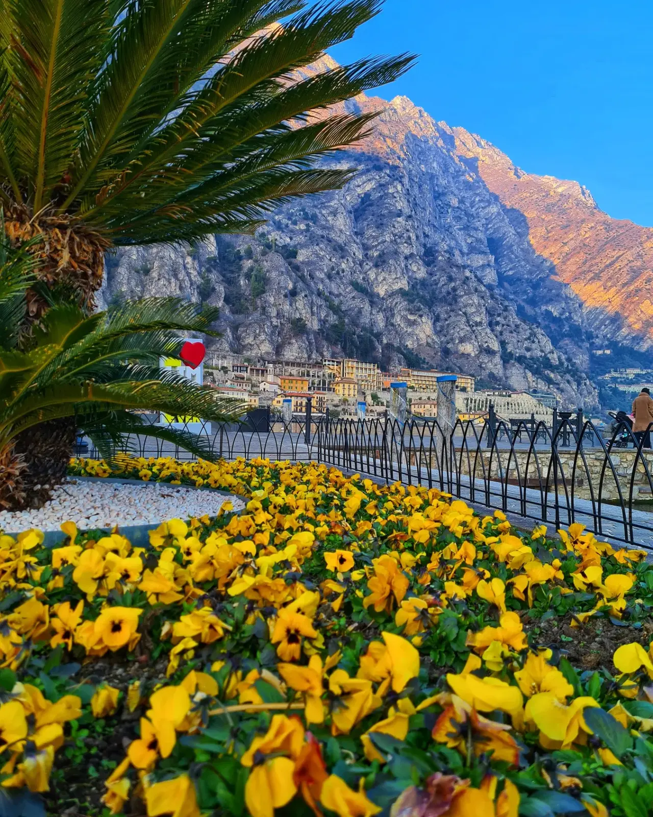
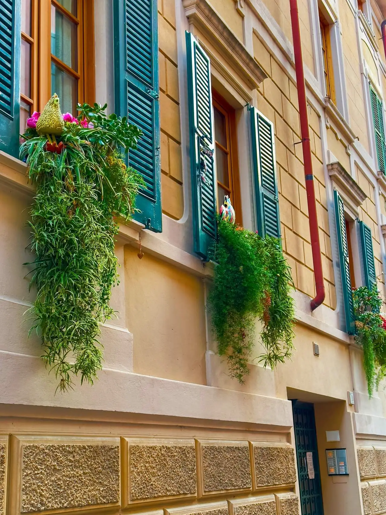
In my opinion, it is one of the most beautiful towns around Lake Garda, which, as the name suggests, has a lot to do with lemons. Be sure to take the time to walk the narrow streets that go up and down.
Here, in Limone Sul Garda, you can buy all kinds of souvenirs related to lemons, just like on the Amalfi Coast. For a small fee, take a stroll through the lemon groves of Limonaia del Castèl, which is only a few minutes away from the designated parking area.
If you are lucky and can find parking, the Ciclopista del Garda is also beautiful. A built path along the edge of the cliff above the lake. It is always difficult to find parking relatively nearby. Otherwise, leave your car in Limone Sul Garda and rent bikes to ride this route. The trail is about 2 kilometers north of Limone.
Riva del Garda
Coordinates: 45°53'04.7"N 10°50'57.9"E
The next place where you could even spend several days is Riva del Garda and it nearby area, because there is a lot to do and see here. Starting with the city itself, which is surrounded by mountain ranges, a beautiful beach area with parks, and stunning views of the lake.
Take the time to walk the Sentiero del Ponale, which is easy to find if you head to the right when looking at the lake. A hiking trail along the edge of the cliff with tunnels, waterfalls, hidden bunkers and of course views. To fully enjoy it, consider that the round trip takes about 5 hours. Depends on how you walk and if you like to explore side paths. In addition, you can also do it by bicycle.
Lago di Tenno and Canale Medieval Village
Coordinates: 45°56'06.7"N 10°48'43.4"E
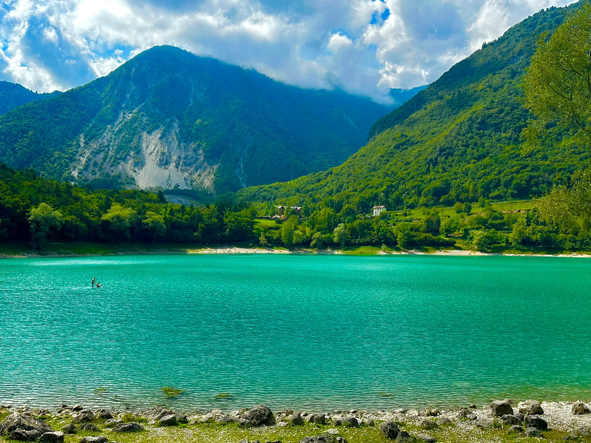
About 5 km north of Lake Garda, a beautiful breathtaking short drive up the mountain is a small beautiful lake - Lago di Tenno. Beautiful because of the water color and the surrounding mountains. But the water is not always that same color. Sometimes the lake is emerald green and other times it's strikingly turquoise. You can walk around the lake, on the left side there's a suspension bridge.
If you go to the right, there's a hiking trail to a beautiful authentic mountain village - Canale di Tenno. Of course, you can also drive, but it's not far from the small lake, plus the views are beautiful.
You can spend an hour wandering through the cluster of ancient houses, where time seems to have stopped in the shady streets. The village was abandoned until the 1960s when a group of artists "revived" it. Cars are not allowed in the village, and several parking lots are located at its base (45°55'43"N 10°49'39"E).
Varone Waterfalls
Coordinates: 45°54′42″N 10°50′7″E
A little down, about seven kilometers, from the medieval village of Canale di Tenno, are the Cascate del Varone. These are two approximately 100-meter-high waterfalls carved into the rock, with a small botanical garden in between. When visiting, be sure to wear a raincoat and even a warmer pullover, as the walkways and viewing balconies built into the rock often lead directly under the water sprays. Varone Waterfalls is open until 7:00 PM, the ticket costs €7.
If you're heading back to Riva del Garda at night, you'll have a wonderful view of the illuminated villages below. If it happens, drive slower to quickly stop somewhere, where there's space, as there are very few places to stop, it's a mountain road after all.
If you return to Riva del Garda after dark, you will be treated to a wonderful view of the illuminated villages below. Just in case, drive slower so you can quickly stop somewhere where there's a spot, because there are very few places to stop, as it's a mountain road.
Arco Castle Ruins
Coordinates: 45°55′17″N 10°53′23″E
In the very north of Lake Garda lies the town of Arco. Here, on a rocky hill, are the ruins of the approximately thousand-year-old castle, Castello di Arco. From the parking lot, head south, turn right through the old town along Via Castello, and then follow the path up the hill.
The path is on the southern slope of the hill, and I recommend bringing a bottle of drinking water on hot days. Once you reach the top, your efforts will be rewarded with views of the castle ruins and the distant Lake Garda. The ticket for one person costs €5. Refreshments and ice cream can be purchased at the kiosk. The visit, including travel time, can take up to 3 hours.
Marmitte dei Giganti
Coordinates: 45°52'48.2"N 10°53'06.7"E
In addition, breathtaking views can be enjoyed from Marmitte dei Giganti. This place offers beautiful views both in the daylight and in the dark. There is a conveniently located parking lot where you can conveniently park your car, allowing you to take a leisurely walk and fully immerse yourself in the surroundings.
A short distance from the parking lot, walking down the hill on the right side of the road, you will find Marmitte dei Giganti themselves. These geological formations, with a small cave, can be walked for free.
Sentiero Busatte - Tempesta
Coordinates: 45°51'56.8"N 10°52'53.9"E
Once in Torbole, continue to the Busatte area and a steep road brings you near the Busatte Adventure Park. Here you can park your car. There are various parking lots where you can leave your car, some located in small rocky ravines, others on the road. If it is the height of the summer season, finding a place can be more difficult and it is better to arrive early, at other times of the year there will be no problems.
The Busatte Tempesta panoramic route is an easy hike with an elevation difference of about 320 meters, about 4 kilometers in each direction.
The peculiarity of this road is the various stairs that connect the pieces of the mountain ridge, a total of about 400 steps. Practically the entire route winds along the slopes of Mount Baldo, and these stairs are attached to the edge of the cliff overlooking Lake Garda.
Once you arrive in Tempesta, you can choose to go back to Busatte either by bus or continue walking.
It is possible to make both there and back in about three hours. Obviously, you can decide to take a more leisurely pace, allowing no more than an extra hour.
Malcesine and Monte Baldo
Coordinates: 45°45'59"N 10°48'46"E
On the eastern side of the lake, in the beautiful town of Malcesine, find the funicular and ride up Monte Baldo, 1780 meters above the lake. The rotating cabin, which provides passengers with a 360-degree panoramic view, will lift you 1800 meters above the lake in a few minutes (there is a transfer station halfway), and at the top, you will be greeted by unforgettable views and walking trails. You can spend 2-3 hours on the mountain. After descending, it is worth spending an hour walking along the historic Malcesine town coastline.
Alternatively, you can also reach Monte Baldo by car (45°46'58.4"N 10°52'04.5"E), which takes about an hour from Torbole. The road can be quite challenging for some, but it could be a great alternative for those who might be afraid of the cable car or simply want more freedom.
Punta San Vigilio
Coordinates: 45°34'25"N 10°40'30"E
Going further from Malcesine, on the eastern side of Lake Garda, here is the next wonderful place to stop for an hour and a half in a quiet and peaceful corner, yet undiscovered by tourists – Punta San Vigilio.
The path from the olive-tree parking lot leads 300 meters to an old but elegant hotel. There is a quiet and peaceful boat dock, a crescent-shaped pier with outdoor café tables on one of its narrow edges. This place has always attracted with its magical silence, apparent simplicity, and peace.
Lazise
Coordinates: 45°30'26.7"N 10°44'00.8"E
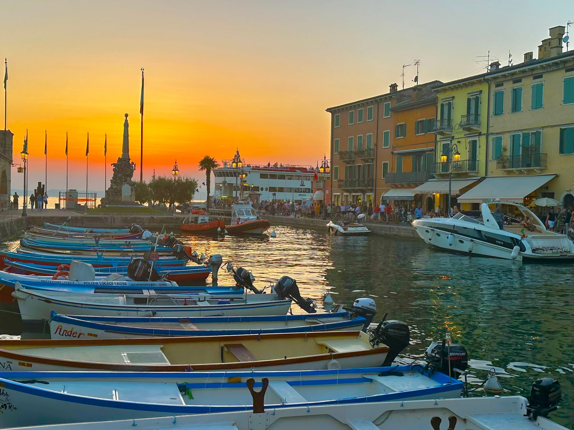
The next place to visit is Lazise. Take a walk along the charming lake promenade, sunbathe on its semi-sandy beaches, and enjoy the magnificent sunsets. Wander through its old town with its narrow streets.
But most importantly, Lazise is home to many amusement and entertainment parks, making it an ideal destination for adrenaline lovers and, of course, families. For example, Gardaland, Movieland, Caneva Water Park, Gardaland SEA LIFE Aquarium, Gardaland LEGOLAND Waterpark, and a bit further away, the Safari Natura Viva animal safari park.
Peschiera del Garda
Coordinates: 45°26'23.4"N 10°41'24.7"E
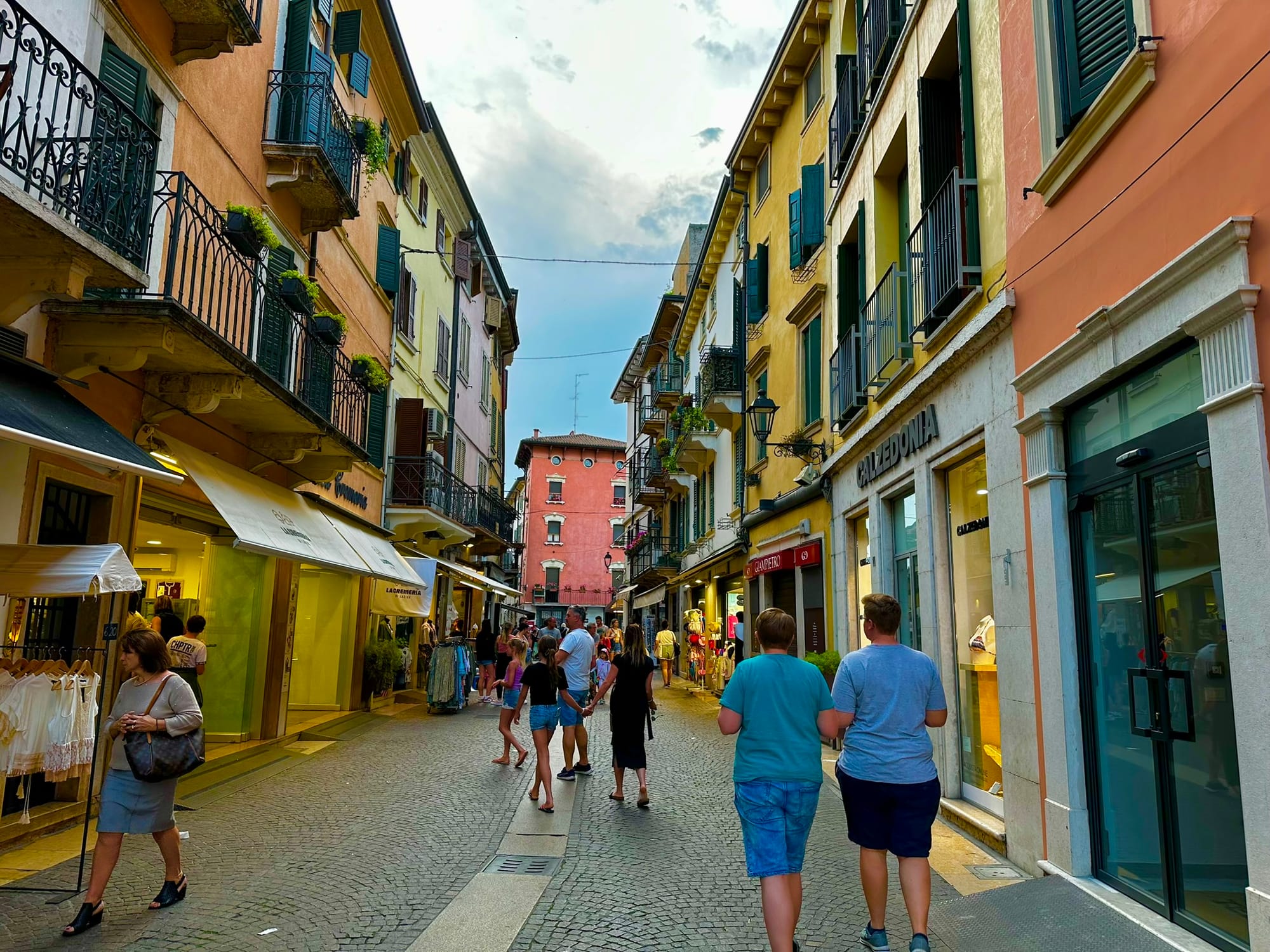
The last but not the least place to visit is Peschiera del Garda. Peschiera del Garda is unique with its network of canals, giving it a charming Venetian feel. These turquoise blue canals are crossed by several picturesque bridges, which are perfect places for photos.
Its old town is surrounded by impressive 16th-century walls, a UNESCO World Heritage Site. The narrow streets are lined with shops, cafes and restaurants, perfect for leisurely strolls. Plan around 3 hours to fully enjoy the charming city.
See you in Part 4, where I will tell you about impressive and worth visiting places around Lago di Garda.
Buon viaggio – happy travels!