The Dolomites are particularly breathtaking at sunrise and sunset, when the Alpenglow (known as "enrosadira") paints the mountains in shades of pink, orange, and red.
Moreover, the Dolomites are a paradise for outdoor enthusiasts. There are countless trails for hikers of all levels, as well as other activities in the summer and skiing opportunities in the winter.
 Liga Rudzite
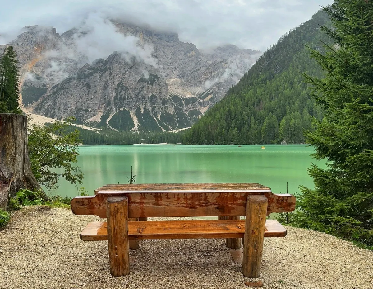
The Dolomites also have a rich cultural heritage. The region is a mix of Italian, German and Ladin influences, reflected in the architecture, languages and, of course, cuisine, where there is a delightful mix of hearty Alpine dishes and Mediterranean flavors.
Tarvisio, Monte Lussari
Coordinates: 46°30′24″N 13°32′2″E
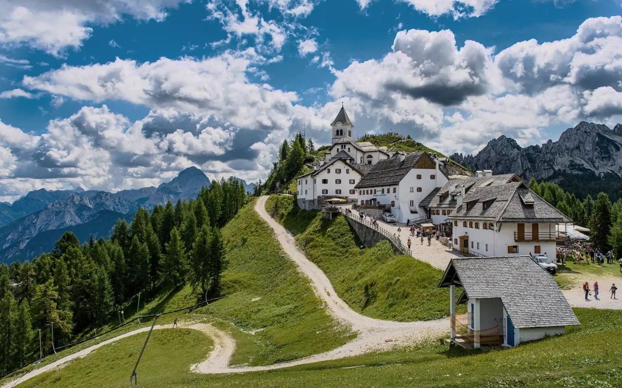
Entering Italy from Austria, 5 km past the border, lies the small village of Tarvisio. We sometimes choose to stop and spend the night here if we have driven to Italy crossing Austria or Slovenia in our car. After long and exhausting days on the road, the realization that the whole trip is still ahead of us is stronger than the fatigue and gives new strength for the onward journey.
After enjoying authentic Italian pizza and a glass of wine in the evening, you'll recover from the long journey and be ready the next morning to explore the beautiful Italian Alpine region. Drive 5 km east to the village of Camporosso, where a cable car leads to Monte Lussari.
The funivia operates from June 1 to September 1, from 9:00 AM to 5:00 PM, on weekends until 6:00 PM, and on Fridays in August until 11:00 PM. A round-trip ticket costs €18. On the mountain, there is a small village - Borgo Lussari, where you will find a café, souvenir shops, and a church.
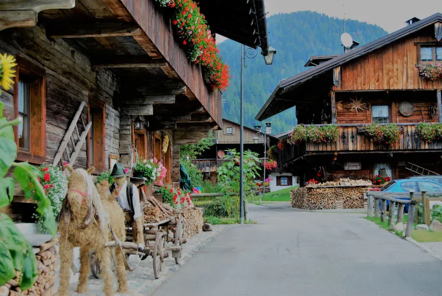
Sappada
Coordinates: 46°34'08"N 12°43'16"E
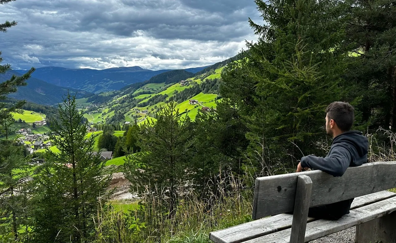
Heading further west towards the Dolomite Alps, there are countless stopping points that invite you to stop and admire the breathtaking mountain landscapes. Along the mountain roads, you will occasionally find a rest stop, and parking is mostly free. I will describe places where several attractions are together and worth stopping for a longer period.
Spend an afternoon leisurely walking through the fairy-tale village of Cima Sappada. Park your car in the small lot by St. Oswald’s Church, and walk north along the narrow streets to see the old wooden houses, decorated not only with beautiful flowers on the balcony railings, under which neatly stacked firewood waits for winter, but also with straw and rag dolls by the doorsteps.
After exploring this "open-air museum," don't put away your camera just yet, because 2 km further west, you will find another Sappada (without the prefix "Cima" – Peak) - Borgate Sappada Vecchia - with an equally beautiful path to walk for an hour and enjoy the peace of a quiet Alpine village - 46°34'11"N 12°42'00"E. Walk 50 steps further, and enter the small chapel on the right side of the road.
That's not all! Walk or drive another kilometer west (parking - 46°34'02"N 12°41'16"E), cross an old wooden bridge and turn left past the fire station (Vigili del fuoco). A ten-minute walk will bring you to the rocky waterfalls - Le Cascatelle.
On the way back, next to the fire station, head up the hill past 12 small chapels - stations to a small shrine on the hill. As we were told by the church caretaker, this local Holy Mountain was created by a local family out of their initiative and funds. In each station, you will see a painting of Christ's Passion. Therefore, this path is called Via Crucis – the Way of the Cross.
Vittorio Veneto
Coordinates: 45°59'55"N 12°17'28"E
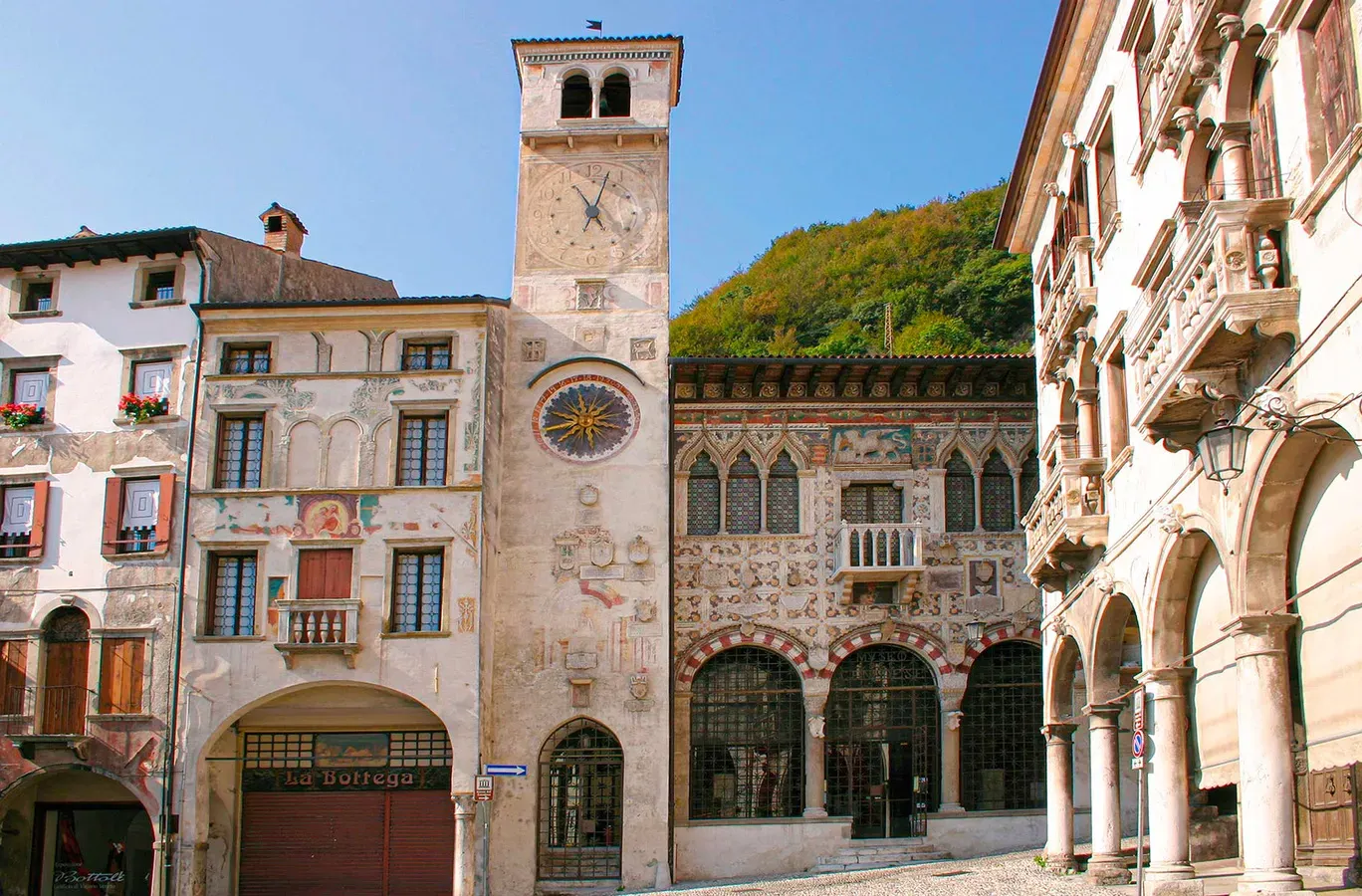
If your route diverges south from the Dolomite Alps, definitely visit and spend an hour and a half walking through the old center of Vittorio Veneto. On maps, you will also find this place named Serravalle, because there were once two municipalities here - Cèneda and Serravalle, which were united into one municipality in 1866 and named Vittorio Veneto after the Italian King Vittorio Emanuele II. There is another parking lot a bit further, past the church (45°59'60"N 12°17'26"E).
Be sure to walk to the bridge over the Meschio River, from which there is a view of Piazza Flaminio with medieval Venetian-style buildings. Right next to the cathedral, you will see the stairs (Scalinata di Santa Augusta), which you can take for about 1 km uphill to the Saint Augusta Shrine, located 200 m higher.
Caglieron Caves
Coordinates: 46°00'29.6"N 12°19'50.1"E
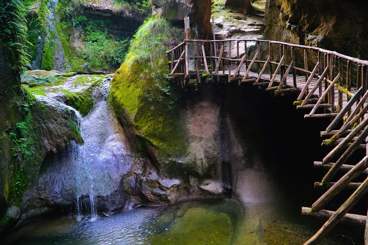
15-minute drive northeast of Vittorio Veneto, spend a couple of hours at the cave and waterfall complex Grotte del Caglieron. Here, among sandstone caves supported by narrow rock pillars, walking paths have been created. The entrance fee is relatively small, only 4 euros, but there is also a paid parking lot.
If you want to hike for several hours, and even take on the challenge of several hikes, then the next few stops will be the right place to do it.
Falzarego Pass and Seggiovia Cinque Torri
Coordinates: 46°31'08"N 12°02'16"E
Now we will go back towards Cortina d'Ampezzo, where there is Falzarego Pass, a spectacular mountain pass. The best thing is that you can enjoy the Falzarego Pass and its stunning views completely free.
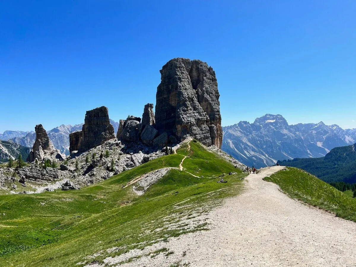
Crossing the 2105 m high Falzarego Pass, you can take the Seggiovia Cinque Torri lift (1889 - 2255 m).
Seggiovia Cinque Torri lift operates until 4:30 PM, and a round-trip ticket costs 26 €. On the mountain, there are walking trails along five impressive rock towers, hence the name – Cinque Torri.
Lago di Sorapis
Coordinates: 46°33'22.5"N 12°12'16.9"E
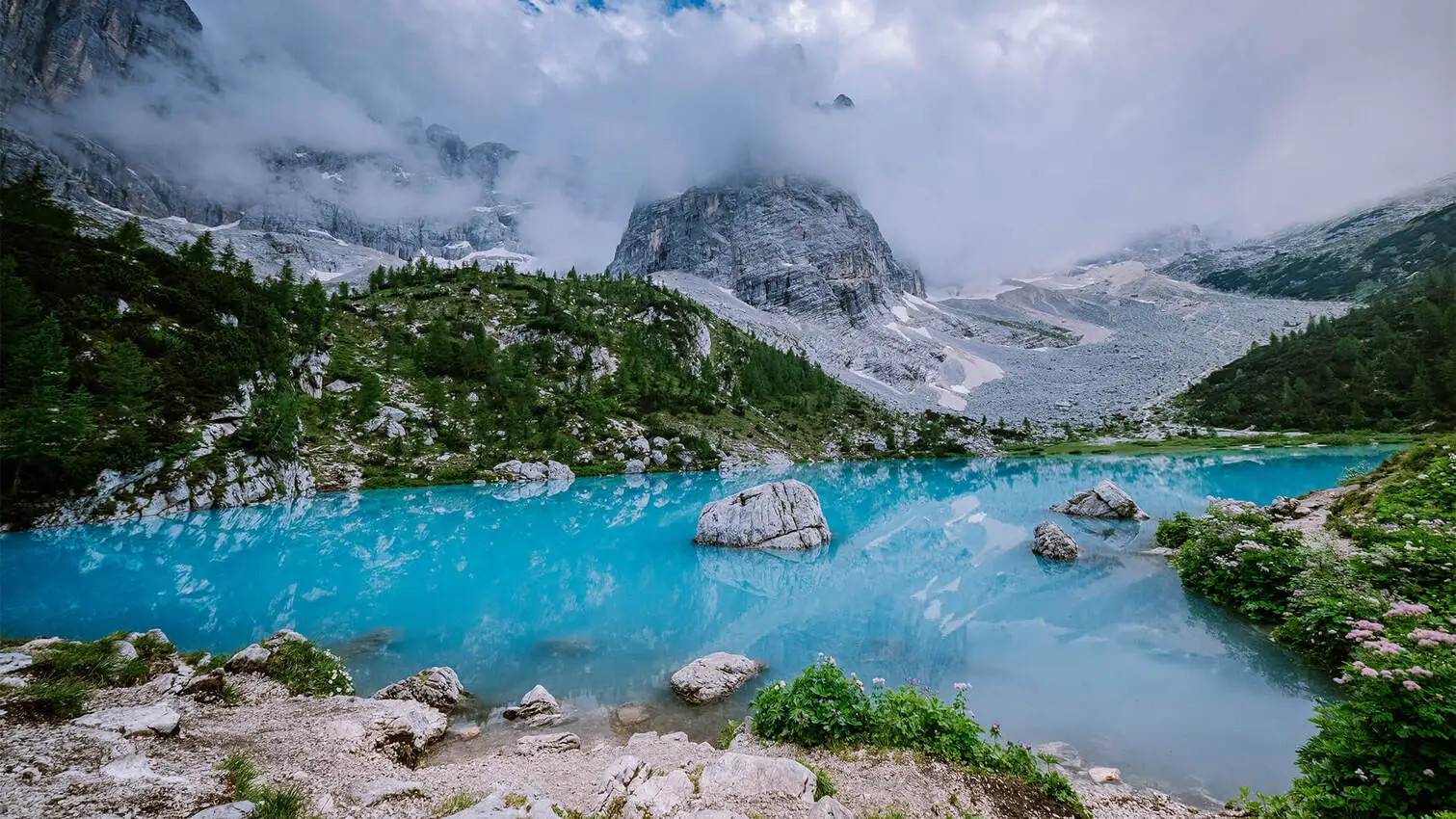
This is where the popular hiking trail to the turquoise lake, Lago di Sorapis, begins.
You can choose this parking lot (46°33'04.2"N 12°11'23.1"E), because since this is one of the most popular places in Italy, there is a chance that the parking lot at the starting point of the hiking trail is already full. There is approximately a 1.5 kilometer difference.
In total, it’s about 6 kilometers to the lake, which can take about three hours in one way. The trail is not the easiest, but the views are definitely worth it.
Just remember to provide yourself with everything you need, because there will be nothing on the way like Refugio etc.
Tre Cime di Lavaredo
Coordinates: 46°36'44"N 12°17'42"E
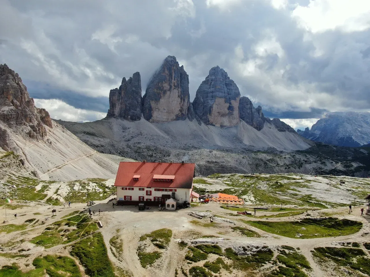
Next, drive through Misurina to Tre Cime di Lavaredo, just 14 kilometers away, not forgetting to stop and admire Lake Misurina itself (46°35'02.7"N 12°15'13.8"E).
The Tre Cime di Lavaredo are three distinctly rocky peaks rising into the skies of the Sesto Dolomites. Here are three adjacent rock peaks: Cima Piccola (Small Peak), Cima Grande (Big Peak), and Cima Ovest (Western Peak).
This mountain group is well-known, so the best time to visit is during the low season, fall when the region is winding down after a busy summer, or early summer when the wildflowers are blooming and the crowds of eager hikers haven't arrived yet.
This route is about a 9 km loop and starts from the mountain rifugio of Auronzo, going north to the rifugio of Lavaredo, and finally to the rifugio of Locatelli Tre Cime. "Rifugio" means a place where hikers can take a break.
Although there is a toll road (30 €), these mountain peaks are undoubtedly worth seeing and hiking.
Alternatively, you can leave your car in this free parking lot (46°35'36.2"N 12°15'49.8"E), which is located just before the toll point, and then either use the shuttle buses, which cost 10 euros per person one way, or, if you have enough time and energy, hike approximately 6 kilometers up to the Rifugio Auronzo, where the hiking trail around Tre Cime di Lavaredo begins.
Lago di Braies
Coordinates: 46°42'04.4"N 12°05'06.4"E

And why not stop by the iconic Lago di Braies when visiting the Dolomites! Drive about 60 kilometers north to reach this beautiful lake surrounded by Dolomite stacks.
Lago di Braies, also known as Pragser Wildsee, is a stunning alpine lake located in the Prag Valley. It is part of the Fanes-Sennes-Braies Natural Park and is considered one of the most beautiful and picturesque lakes in the Dolomites.
One of the favorite activities at Lago di Braies is boating, although it is not one of the cheapest pleasures. I didn't enjoy this entertainment myself, but if you are interested, renting a boat costs about 50 euros for around an hour of boating.
Despite that, there is an easy walking trail around the lake where you can enjoy stunning views from all angles. In addition, there are many other hiking trails.
To avoid any surprises, keep in mind that the Prag Valle has a reservation system in place to manage the large number of visitors during the peak tourist months, which are usually July to September, that cost 18 euros.
Outside of these peak times, you can usually visit without a reservation, just pay for the parking lot P3 - 8 Euros. However, it is always best to check the official website for information updates.
Prato Piazza
Coordinates: 46°39'24.6"N 12°10'30.8"E
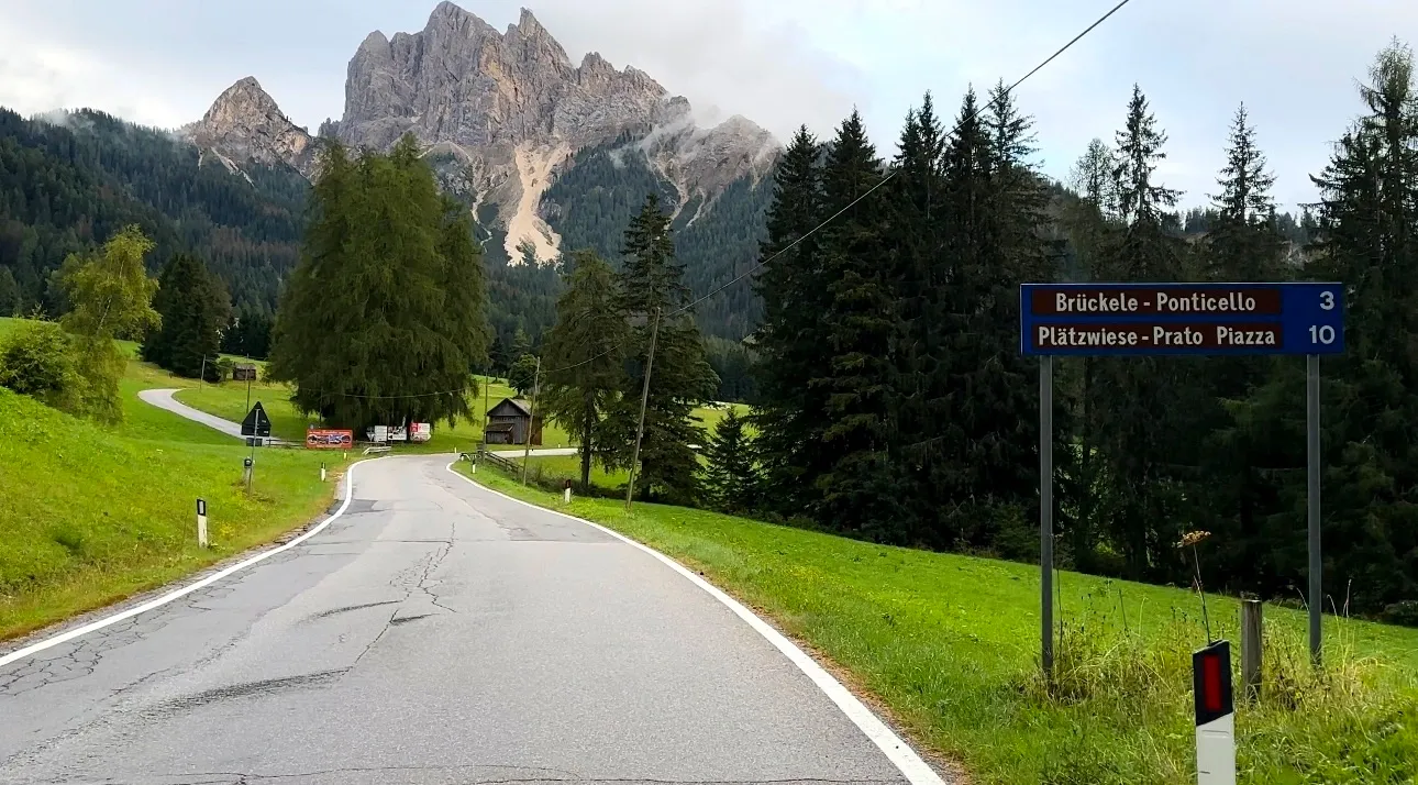
Not far from Lago di Braies is Prato Piazza, also known as Plätzwiese, which is a charming alpine meadow. This picturesque area offers hiking trails with breathtaking views of the Dolomite peaks, including Tre Cime di Lavaredo.
During the high season, traffic is restricted during the day, and you cannot reach it by car. Alternatively, there is a shuttle bus from the parking lot (46°40'39.2"N 12°08'56.2"E) which costs, depending on the season, starting from 3 euros one way, plus a parking fee of 6 euros. You can also take a relatively easy hike of approximately 5 kilometers, which takes about 2 hours.
Funes
Coordinates: 46°38'28.9"N 11°42'55.0"E
Villnöss (Italian: Funes) is a picturesque valley in the South Tyrol region of northern Italy, located just 80 km from Lago di Braies. This valley is famous for its beautiful natural landscape and is part of the Puez-Odle (Geisler) Nature Park. It offers various types of hiking trails and, of course, superb views of the Dolomites.
Be sure to also visit Instagrammable churches such as the famous St. Magdalena Church, with its iconic backdrop against the Odle (Geisler) mountain peaks (46°38'51.2"N 11°42'58.7"E), and the small but picturesque St. Johann in Ranui Church (46°38'09.0"N 11°43'33.1"E), known for its location in a meadow with the Dolomites as a background.
The Zanser Alm, on the other hand, is a lush alpine meadow that serves as a great starting point for hikes and offers stunning views. The parking fee is 8 euros, but like many places during the peak tourist season, it fills up quickly.
For the best views of the Odle Mountains, wait for the sunset; you won't regret it!
Val Gardena
Coordinates: 46°33'15.9"N 11°41'45.5"E
Val Gardena is the next picturesque valley, only about 40 km from Funes. This valley is famous for its beautiful natural scenery and is part of the Dolomiti Superski region, offering different types of hiking opportunities, as well as spectacular views of the Dolomites.
Be sure to also visit villages like Ortisei, Santa Cristina and Selva di Val Gardena and ride the Passo Gardena - Ju de Frara.
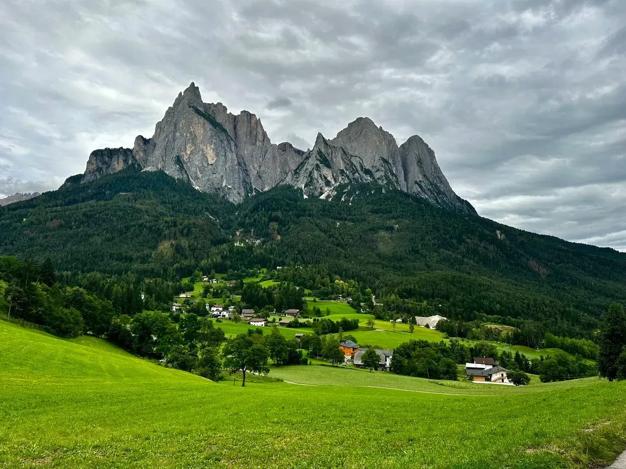
Ortisei is known for its beautiful pedestrian street and traditional woodwork shops, as well as access to Mount Seceda. (46°34'36.1"N 11°40'31.2"E). Mount Seceda is an impressive peak with a height of 2,519 meters above sea level, Seceda offers wonderful views and a variety of outdoor activities in both summer and winter. The mountain is part of the Puez-Odle Natural Park, famous for its unique geological formations and abundant flora and fauna.
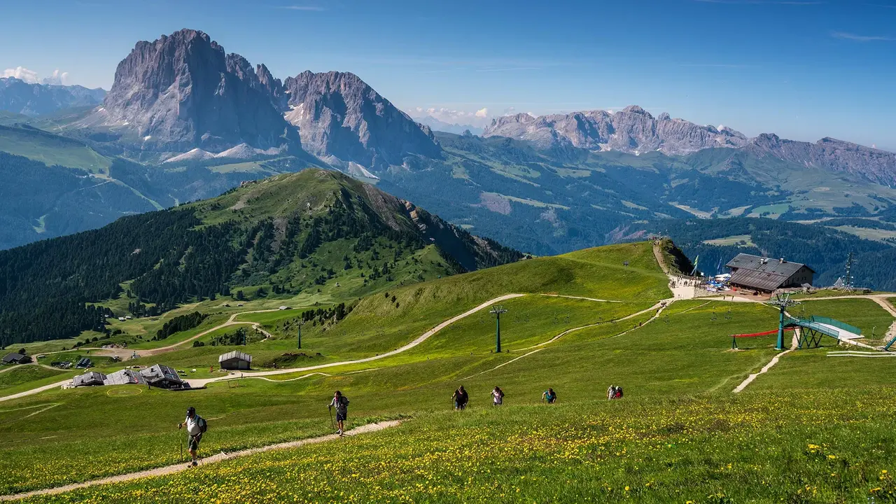
Alpe di Siusi (Seiser Alm)
Coordinates: 46°32'24.7"N 11°33'57.0"E
The next beautiful scenic spot to visit is Alpe di Siusi, only about 10 km from Ortisei. Alpe di Siusi (German: Seiser Alm) is the largest alpine meadow in all of Europe.
The highlight of Seiser Alm is undoubtedly its scenery. Lush green meadows dotted with wildflowers carpet the valley floor, while in the distance rise the majestic Dolomites, their peaks often dusted with snow.
This idyllic scene is further enhanced by charming wooden cottages and grazing cows, creating a postcard-perfect moment.
Alpe di Siusi can be reached by cable car and costs €26.50 round trip.
Let's go on the part 3 of our trip to explore Lago di Garda area.
Buon viaggio – Have a good trip!
Thank you for reading and make sure to subscribe. We're constantly exploring new destinations and share our stories, tips, and the beauty we discover along the way.